
Earth Imaging & Sounding
Building a picture of the subsurface
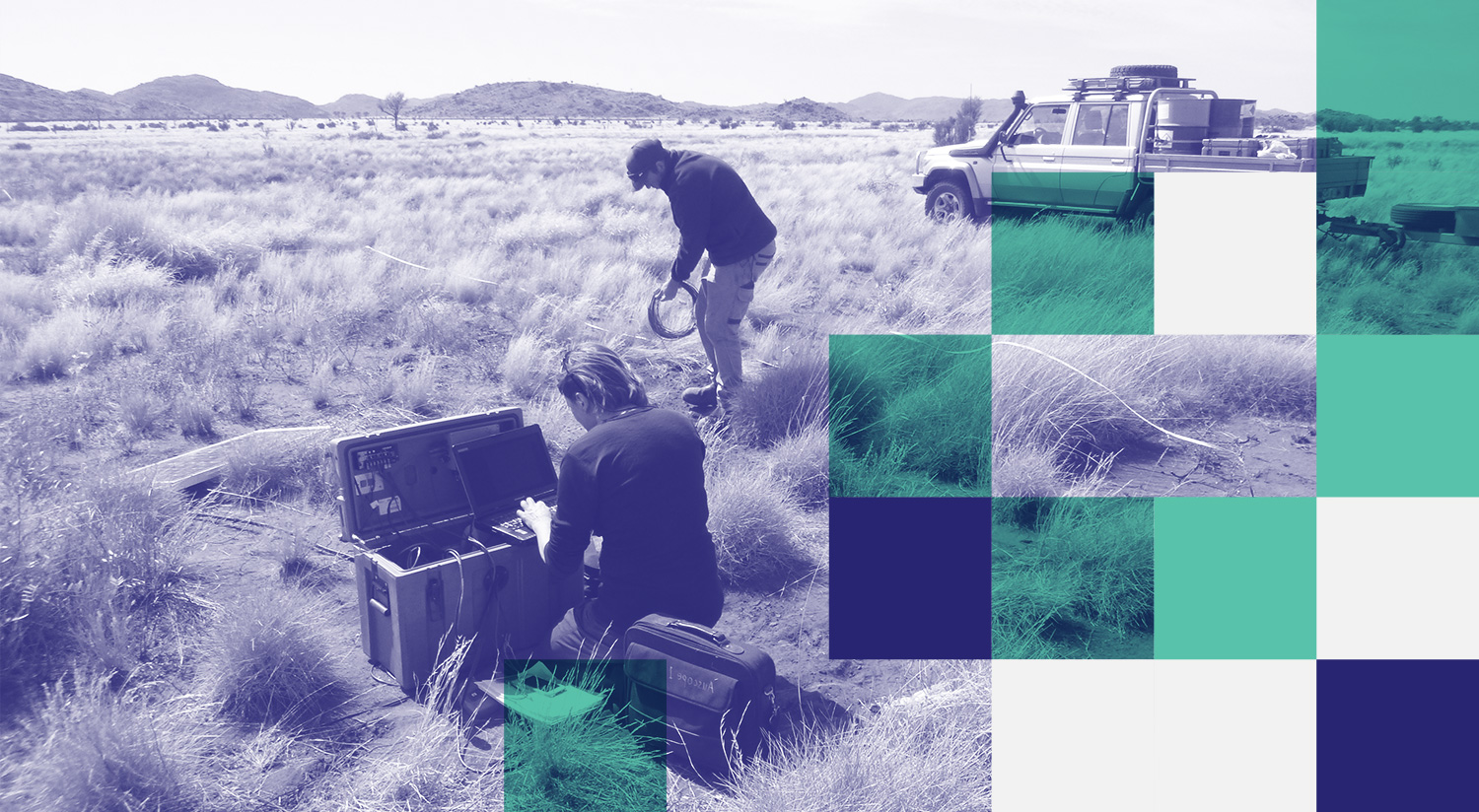
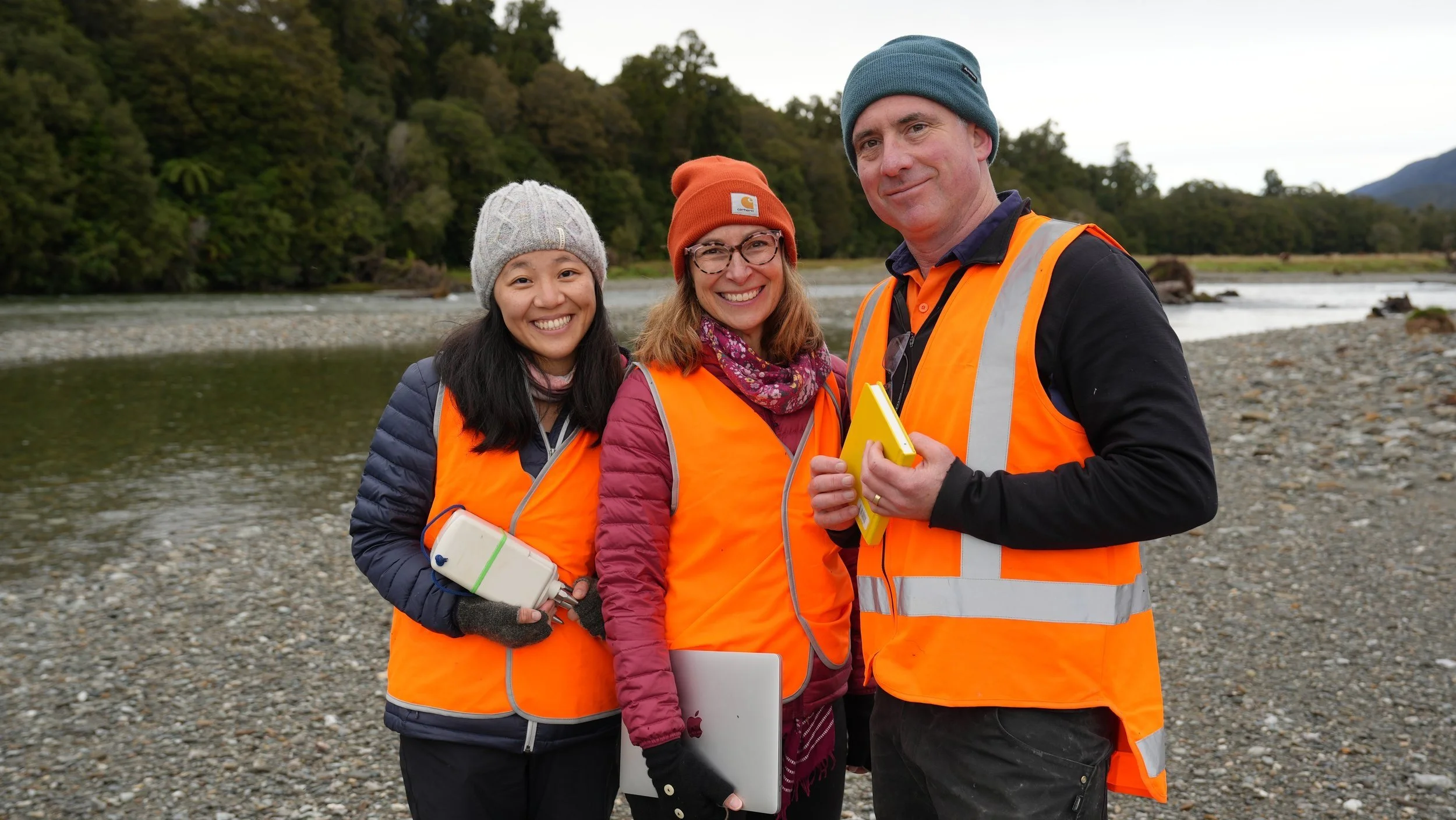
Deploying AusLAMP magnetotelluric equipment near the Musgrave Ranges, SA: Philippa Mawby of Adelaide Uni and Sam Henschke of Helifarm. Image: Dr. Bruce Goleby.
AuScope’s Earth Imaging & Sounding program supports research into the structure and evolution of the Australian continent. By imaging the subsurface from near-surface layers to the deep crust and upper mantle, the program underpins research into tectonics, mineral systems, earthquakes, and natural hazards across Australia and surrounding regions.
We bring together national instrumentation pools, field programs, and open data systems that enable researchers to see inside the Earth at unprecedented scale and resolution using seismic and magnetotelluric techniques.
What we’re working on
Collecting data for the Aus Array Program in South Australia and Western Australia
Managing instrument access through ANSIR
Providing access to exascale and AI ready time series datasets and compute in partnership with NCI
Distributed Acoustic Sensing (DAS) experiment across New Zealand’s Alpine Fault
Coordinating F.A.I.R. passive seismic datasets archived at the FDSN AusPass Data Centre.
Data and access
AusPass is Australia’s FDSN data centre for the acquisition, management, and distribution of passive seismological data.
AusPass provides open access to more than 35 years of seismic data from legacy and current experiments, including national rolling arrays and regional deployments across Australia, New Zealand, and Indonesia. New datasets are added regularly as projects are completed.
Researchers can explore, access, and reuse data through AusPass for a wide range of scientific and applied research.
Research facilities and tools
Since 2006, AuScope’s Earth Imaging & Sounding program has invested in the purchase, upgrade, and maintenance of nationally shared geophysical instrumentation, including:
Broadband and short-period seismometers
Portable and nodal seismic arrays
Ocean bottom seismometers
Distributed acoustic sensing interrogators
Magnetotelluric broadband and low-frequency systems
Borehole seismometers and tilt-meters
Earth tide gravity meter
Various down hole and lab based geothermal and heat-flow instruments and sensors
Instrumentation is held across partner institutions and deployed through coordinated national field programs. All data collected using AuScope supported equipment are archived and made openly available via AusPass.
AusLAMP
The Australian Lithospheric Architecture Magnetotelluric Project (AusLAMP) is a national survey collecting long period magnetotelluric (MT) data from around 3,000 sites across Australia. The project is building new dataset to map electrical conductivity in the crust and upper mantle, improving understanding of Australia’s geology and tectonic evolution. The results will help identify regions with potential for mineral and energy resources.
Impact
Explore recent case studies and highlights that demonstrate how Earth Imaging & Sounding is transforming our understanding of Australia’s deep structure and geodynamic evolution.


Earth Imaging and Sounding enables research outcomes such as:
New insights into crustal and lithospheric architecture across Australia
Improved understanding of mineral system controls at regional and continental scales
Advances in earthquake and tsunami hazard assessment
Integration of seismic and MT data into national Earth models
These capabilities underpin Australia’s international leadership in large scale seismic deployments. From the Skippy Project in the early 1990s through to the BILBY, TIGGER, WOMBAT and subsequent experiments, AuScope investments have positioned Australia as a major contributor to global seismological research.
Earth Imaging & Sounding in the media


Our Strategic Projects


Looking ahead
International Earth imaging is increasingly moving towards high-density, large N seismic arrays that use hundreds to thousands of instruments to achieve much higher spatial resolution.
AuScope is expanding national capability to support these approaches, with current holdings including nodal and broadband seismic instruments. These technologies enable new applications such as rapid post-earthquake deployments, monitoring induced seismicity, and ultra-high resolution imaging of the crust.
Earth Imaging & Sounding will continue to support research across Australia and neighbouring regions, strengthening international collaboration and advancing understanding of seismic and tsunami hazards.
Get involved
Use AuScope Earth Imaging instruments in your research. Applications to access these instruments are managed through ANSIR.
Applying for access to Earth Imaging instrumentation
Using AusPass data for new research
Participating in national field programs and collaborations
Access to AuScope portable seismic and magnetotelluric equipment is available through a short scientific proposal process assessed by the ANSIR Access Committee, based on scientific merit and instrument availability.

News


PROGRAM LEADER
Prof. Meghan Miller
Australian National Uni

For more information on current and potential projects please get in touch with Meghan.
PROJECT LEADERS
Dr. Graham Heinson
Adelaide Univeristy
Dr Robert Pickle
Australian National University
DURATION
Since 2006
QUICK LINKS
AuSIS website, Facebook
and Twitter pages
ACCESS TOOLS & DATA
ANSIR Research Facilities
for Earth Sounding
Passive Seismic Data and Data Products available via AusPASS