
Simulation, Analysis & Modelling
Digitally recreating Earth processes

Earth reconstruction of a selection of the GPlates data at 67 million years ago. Source: Earthbyte.
Simulation, Analysis and Modelling (SAM) program provides open-source software that helps researchers and industry model and visualise the Earth’s dynamic systems from deep mantle processes to surface environments. These tools enable breakthroughs in geodynamics, resource exploration, energy, mining and natural hazard research.
What We’re Working On
Developing next generation modelling and simulation tools that improve understanding of Earth system processes, including sea level change, deformation, and natural hazards
Advancing open source software that improves accuracy, efficiency, and scalability of geodynamic and geophysical modelling
Supporting high performance and cloud enabled computing environments for large scale simulations
Strengthening national capability in digital Earth science through collaboration, training, and shared software platforms
Research Tools and Software
We support a suite of widely used, open source modelling and analysis tools developed in partnership with Australia’s geoscience research community.
Underworld
A high-performance, open-source code for simulating geodynamics using a particle-in-cell finite element approach.
Application: Underworld allows researchers to model processes such as plate movement, subduction, basin evolution, and crustal deformation using a Python-based interface optimised for parallel computing.
[Download Underworld2] [User Manual] [View Source Code]
Learn More: [Underworld Blog] [Facebook Group]
GPlates
An interactive desktop application for exploring plate tectonics through time. It combines plate reconstruction, GIS functionality and raster visualisation to analyse the movement of continents and ocean basins.
Application: Modelling global plate motions, reconstructing paleogeography and investigating sediment transport and basin formation.
Available for Windows, Linux and MacOS.
[Download GPlates] [User Manual]
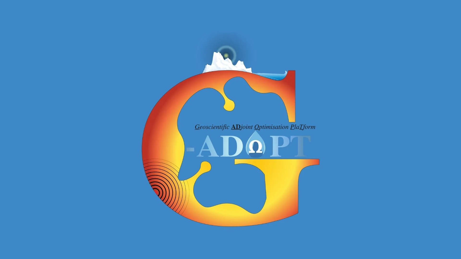
GAdopt
A framework for Glacial Isostatic Adjustment (GIA) and Earth deformation modelling. It integrates solid-Earth physics, ice-mass changes and sea-level variations to study the response of the planet to surface loading over time.
Applications: Supporting GIA modelling and improving understanding of ice-Earth interactions and mantle viscosity structure.
[Visit GAdopt Website]
M@TE
A modelling environment for investigating the coupled thermal and mechanical evolution of the mantle. It supports integration with other geodynamic models to better understand heat flow, convection, and long-term tectonic behaviour.
Application: Exploring mantle convection, heat transport, and links between surface and deep-Earth processes.
Researchers across Australia can use our open-source software, collaborate on modelling projects, and connect with our developer community through shared platforms and online portals.
Impact
Discover our recent case studies and highlights, showcasing how the Simulation, Analysis, and Modelling (SAM) program enables researchers to model complex Earth systems and address real-world challenges in geoscience.


Simulation, Analysis & Modelling enabled research has delivered outcomes including:
Launched Underworld2 into the cloud thanks to a collaborative project between AuScope’s AVRE and SAM — Underworld teams (2018).
Simulated early plate tectonic initiation (“catastrophic switching on”) using Underworld2 (Beall, Moresi & Cooper, 2018).
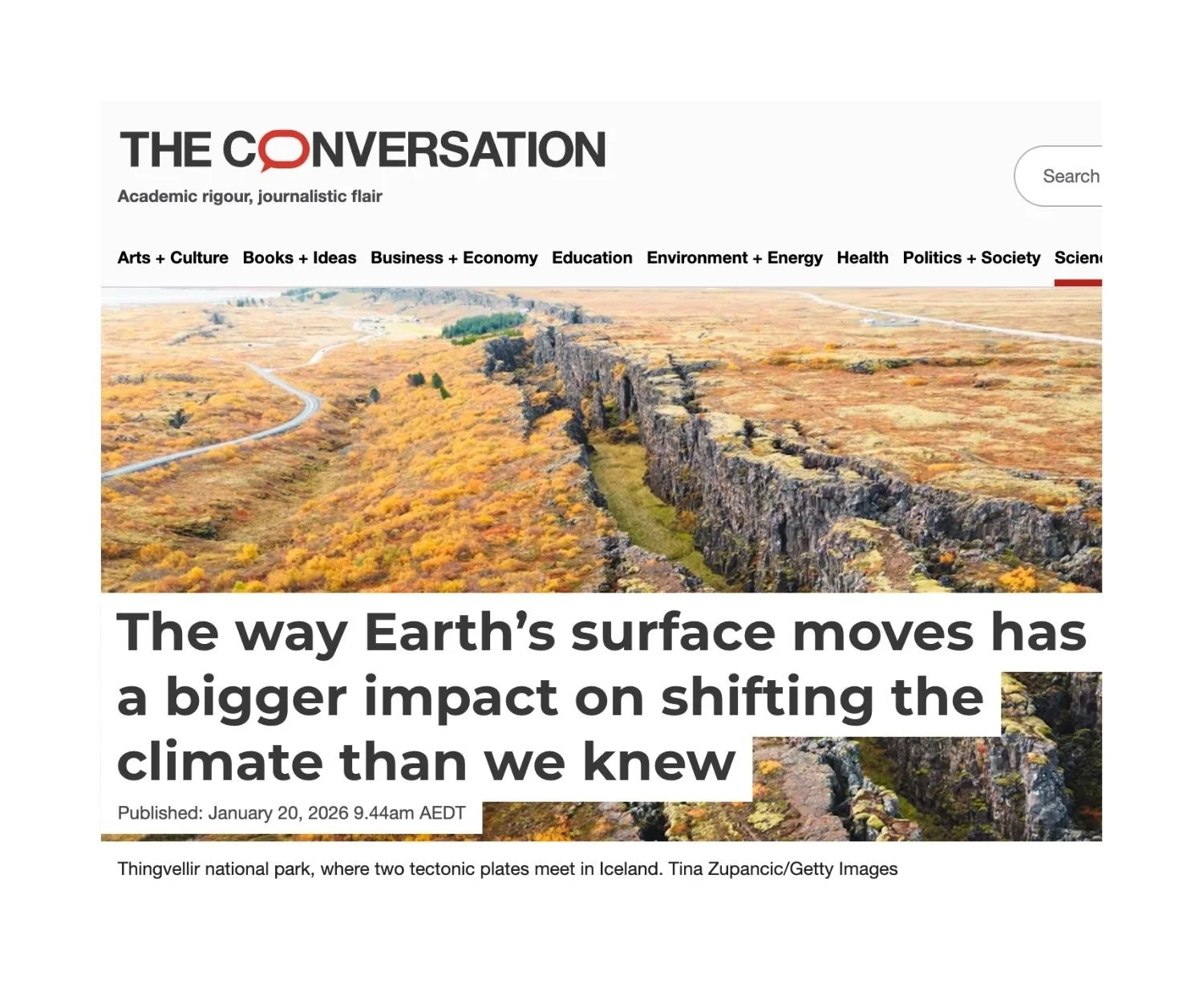
Resolved how Australia’s Eastern Highlands formed using GPlates reconstructions — linking uplift, sediment transport and basin development.
Enabled national-scale geophysical inversion through esys-Escript and the AuScope Geophysical Data Portal.
Built Australia’s first lithospheric density field model using the AUSREM seismic dataset.
Simulation, Analysis & Modelling in the media


Our Strategic Projects


Looking ahead
Simulation and modelling are increasingly central to Earth science research, enabling integration of large datasets, advanced numerical methods, and high-performance computing.
SAM will continue to evolve its software and digital infrastructure to support larger, more complex simulations, tighter coupling between models and observations, and broader access to digital Earth science tools across Australia and internationally.
Get Involved
SAM welcomes collaboration across research, government, and industry.
You can get involved by:
Using SAM open source software in your research
Contributing code or documentation
Participating in collaborative modelling projects
Engaging with the developer and user community
Our News


Watch Earth’s Continents Move Through Time
PROGRAM LEADER
Prof. Louis Moresi
Australian National University

PROJECT LEADERS
Underworld, Australian National University
Prof. Louis Moresi
GPlates, University of Sydney
Prof. Dietmar Müller
DURATION
Since 2006
QUICK LINKS
Underworld
Earthbyte
esys-Escript