
Last stop, Cape York: Queensland complete as AuScope's deep-Earth map of Australia nears completion
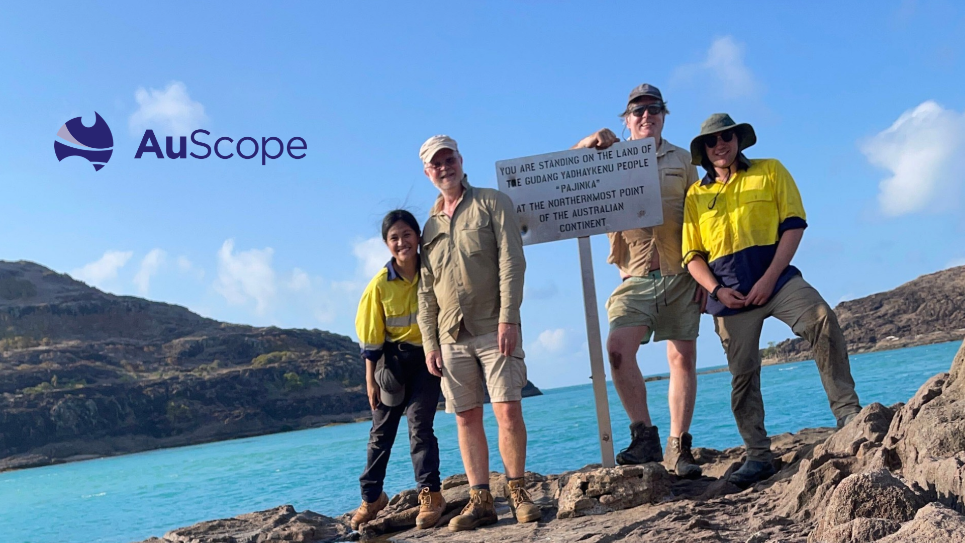
Members of the AusLAMP team celebrating the last of the instruments for Queensland installed in Cape York.
Last stop, Cape York: Queensland complete as AuScope's deep-Earth map of Australia nears completion
At the northern tip of Australia, a small instrument sits buried in the ground, quietly recording the Earth's natural magnetic and electric rhythms. It is the last of 16 installed across Cape York over the past week, completing a network that will let scientists map Queensland hundreds of kilometres beneath our feet.
The milestone brings AusLAMP (Australian Lithospheric Architecture Magnetotelluric Project) a big step closer to imaging the whole continent. Funded by Geoscience Australia, State and Territory Geological Surveys and AuScope, AusLAMP reveals deep structures that help explain how Australia formed. It will also help find the copper and critical minerals needed for net zero, a key goal of the Australian Government’s Future Made in Australia plan.
Prof Graham Heinson, who leads the magnetotelluric imaging facility at Adelaide University, said AuScope’s accelerated investment in the project supported the team to fast-track instrument deployment across the remaining two-thirds of Queensland.
"Queensland is a huge state, and finishing it puts us within reach of something few countries have attempted: a deep map of an entire continent. That map will tell us how Australia was built and help point to where the resources of the future may be found," said Prof Heinson.
The final push to Cape York
Two teams of four, including AuScope’s National Geophysics Program Manager Dr Ben Kay, installed the final 16 instruments in just seven days, then met at the Australian Society of Exploration Geophysicists Discover 2026 conference in Cairns.
"AusLAMP shows what national research infrastructure makes possible. No single Government agency or university could map a continent alone, but together we're creating a resource every Australian geoscientist can use," said Prof Heinson.
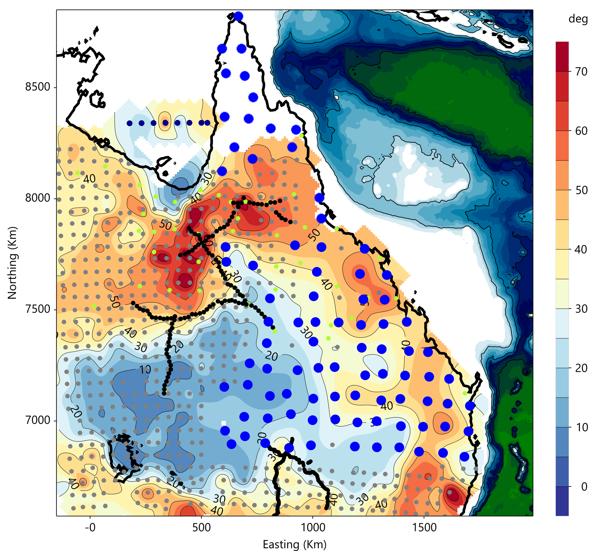
Magnetotelluric coverage of northeast Australia; large blue circles are the new sites funded by AuScope; smaller circles (grey, green and black) are sites collected over the past decade. The background map of phase (in degrees) shows the Earth’s magnetotelluric response, where blue colours indicate a more resistive structure, and red colours are more conductive. Image: Adelaide University.
Mapping what lies beneath
AusLAMP uses a technique called magnetotellurics, which measures tiny natural changes in Earth's magnetic field to work out how easily electricity flows through the ground.
From these measurements, researchers build 3D images reaching several hundred kilometres deep, revealing clues about the temperature, water content and chemical make-up of rocks.
What AusLAMP can discover
Copper and critical minerals
Copper is vital to a net zero future, carrying electricity through power lines, wind turbines, solar farms and electric vehicles. Yet the world does not have nearly enough.
Many copper and critical mineral deposits formed where hot fluids travelled through deep pathways in Earth’s crust and mantle. AusLAMP reveals these pathways, allowing more targeted searches with fewer drill holes and less disruption to the land.
Groundwater
AusLAMP data can help scientists study and find groundwater, one of Australia's most precious resources, particularly in dry regions. Mapping groundwater is part of the Future Made in Australia plan, and AusLAMP adds to this national picture.
Australia's hidden volcanic past
Australia has a surprising number of volcanoes along its east coast, from Queensland to South Australia. The youngest, Mount Schank in South Australia, last erupted about 4,500 to 5,000 years ago, around the time Egypt’s Great Pyramid was being built.
AusLAMP data shows the base of the crust beneath south-eastern Australia’s volcanic regions, about 40 km down, reaches around 900°C, close to the point where rocks begin to melt. This helps explain why the region has been home to hundreds of volcanoes over the past 65 million years.
Space weather hazards
Every so often, the Sun emits huge bursts of energy towards Earth. These solar storms can push electrical currents through the ground and into the power grids, pipelines and railways we rely on, potentially damaging equipment.
Because AusLAMP measures how easily electricity flows through the ground, its data can be used to create space weather hazard maps showing which infrastructure is most at risk.
Built on national infrastructure, open to all
AusLAMP began in 2012 with around 100 new sites a year. AuScope’s investment in 2024 has since accelerated the program, with sites every 100 km forming a national grid that will cover most of the country with >400 new sites by the end of 2027.
AusLAMP data is free for researchers, industry and government through AuScope's AusMT data portal, giving the Australian geoscience community a shared foundation for discovery.
AusLAMP is an AuScope project, made possible through AuScope’s funding from the Australian Government's National Collaborative Research Infrastructure Strategy (NCRIS). The program is in partnership with First Nations and landholder custodians of the lands on which measurements are made.
Share our stories
This story can be shared and adapted with attribution under a Creative Commons licence. Last stop, Cape York © 2026 by AuScope is licensed under CC BY 4.0.
IN A NUTSHELL
With accelerated investment from AuScope, scientists have placed the final instruments in Cape York to map what lies deep beneath Queensland. The data will help explain how Australia formed and where to find the copper and other minerals we need.
FURTHER INFORMATION
Margiono, R., Heinson, G. (2026). Mantle melting and lithospheric structure beneath eastern Australia's Cenozoic volcanoes from 3D magnetotellurics. Scientific Reports 16, 14214.
AusLAMP data collection on AusMT
CONTRIBUTOR
Prof Graham Heinson, Program Director, School of Physics, Chemistry and Earth Sciences and College of Science, Adelaide University