Piecing together the critical minerals puzzle with AuScope
The building blocks of tomorrow's technologies begin with understanding Earth's geology. AuScope is proud to support the research, making it possible.
From smartphones and electric vehicles to wind turbines and solar panels, modern technologies depend on critical minerals. However, despite having some of the world’s largest critical mineral resources, finding new deposits in Australia is becoming increasingly complex. AuScope’s NCRIS-enabled research infrastructure is building a clearer picture of Australia’s hidden geology, helping the sector make smarter exploration decisions and supporting future critical mineral discoveries.
You may have never heard of neodymium, gallium, or silicon, but chances are you’ve used technologies that depend on them. The smartphone in your pocket, the electric vehicles on our roads, and the solar panels powering our homes all rely on these and other critical minerals. They are the building blocks of the technologies that power modern life.
As the world transitions to clean energy, critical minerals are becoming increasingly important. Batteries, wind turbines and other renewable energy technologies all rely on critical minerals such as lithium, cobalt and nickel. By 2040, the International Energy Agency estimates that demand for many of these materials will increase severalfold, making it more important than ever to secure Australia's future supply.
Yet, while Australia holds some of the world’s largest critical mineral reserves, finding them is only getting harder. No single instrument, tool or dataset can reveal the full picture.
Understanding where we might find critical mineral deposits, how they form, and how to extract them more safely and effectively requires bringing many different pieces of the puzzle together.
Fortunately, it’s a puzzle that AuScope’s research infrastructure is helping to solve.
“AuScope is Australia's national geoscience research infrastructure provider. We connect data, tools and facilities across Geoscience Australia, CSIRO, universities and state geological surveys, funded through NCRIS, so researchers can understand what's beneath our feet.”
– Dr Tim Rawling, CEO of AuScope
The first challenge: Where should we look?
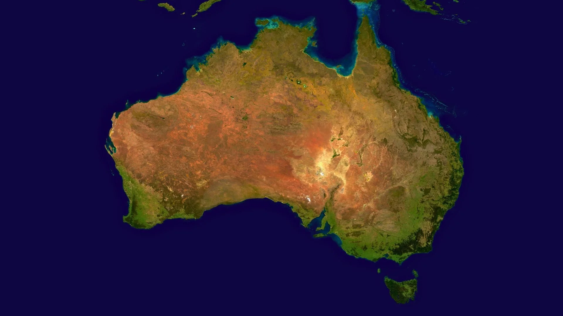
Where do we start looking for critical minerals? It begins with understanding what's happening beneath the surface, often before a single drill hole is made.
Finding a new critical mineral deposit isn't as simple as picking a spot on a map and drilling at random. With much of Australia’s most promising mineral deposits hidden beneath layers of sedimentary rock, there aren’t many clues at the surface that tell us where these deposits might be.
“The easy, near-surface deposits are largely mapped out. What's left is deeper, hidden under cover, and needs much better data to locate. You can't just walk the ground and find it anymore.”
– Dr Tim Rawling, CEO of AuScope
The first piece of the puzzle requires us to build a picture of the Earth beneath our feet to understand where critical mineral systems may have formed.
Geoscientists can do this without even breaking ground.
AusArray and WA Array: listening to the vibrations beneath our feet
One way to locate and identify potential mineral deposit sites is by using seismometers – sensors the size of a milk bottle that ‘listen’ to subtle vibrations from earthquakes, waves or wind. By analysing how quickly vibrations travel between seismometers, researchers can understand the structure and composition of the Earth beneath the sedimentary rock that covers much of Australia. This information can be used to create images of Earth’s structure, helping us better locate mineral deposits.
Over the last decade, hundreds of seismometers have been deployed across Australia through the Australian Passive Seismic Array Project (AusArray), a national collaboration between government, universities, Geoscience Australia and AuScope.
Now, AuScope is supporting an ambitious project to extend the network into Western Australia. The WA Array, a 10-year initiative delivered in partnership with the Western Australian Government and Geoscience Australia, will progressively deploy and redeploy 165 seismometers across the state.
Dr John O’Donnell from the Geological Survey of Western Australia said that the WA Array uses seismic waves as a noninvasive way to see into the bedrock beneath WA’s red veneer of dirt.
“It helps narrow the search because we can non-invasively see through the red dirt that’s hiding the bedrock and identify prospective areas where mineral systems may have formed.”
– Dr John O’Donnell, WA Geological Survey
Access AuScope's national geophysical instruments through ANSIR and seismic data through AusPass.
AusLAMP: observing Earth’s magnetic and electric field
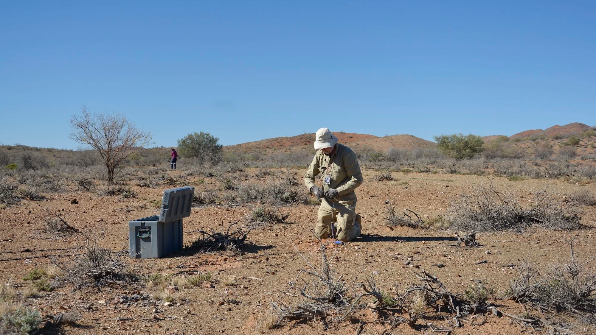
Field technician Goran Boren deploys a magnetotelluric station in remote South Australia as part of the AuScope funded Curnamona Cube project. Once installed, the instrument quietly records natural variations in the Earth's electric and magnetic fields, helping researchers build a three dimensional picture of the geology hidden beneath our feet. Image: Jarred Lloyd, Adelaide University / AuScope.
However, surface observations, such as those collected by seismometers, only tell part of the story. For some regions, seismic techniques sometimes provide little to no signal, and other approaches are needed to better understand what lies beneath.
This is where magnetotelluric (MT) imaging comes in.
MT instruments measure the Earth’s electrical and magnetic field. Scientists can measure changes in these signals to assess Earth’s electrical resistivity and, in turn, learn about its structure and composition, which can then be used to evaluate a region's mineral potential.
Through the Australian Lithospheric Architecture Magnetotelluric Project (AusLAMP), AuScope is supporting a national survey collecting MT data from 3,000 sites across Australia. The dataset will help us understand Australia’s geology and how its tectonic plate has evolved over millions of years, providing insights into why minerals become concentrated in certain regions. The MT instruments used in AusLAMP are jointly provided by AuScope and Geoscience Australia.
Professor Graham Heinson, who co-leads the AusLAMP project, said the MT instruments provide images of Earth’s resistivity from the surface to depths of hundreds of kilometres.
“The AusLAMP program provides coast to coast coverage of geophysical soundings to unlock the deep geological history of the Australian continent. This provides insights into the geological evolution over 4 billion years and identifies regions that may contain critical mineral resources.”
– Professor Graham Heinson, Adelaide University
Dr Ben Kay, National Geophysics Program Manager at AuScope, explained that AusLAMP isn’t about finding individual ore bodies, but understanding the deep architecture of the Australian continent.
“When that information is combined with other geological and geophysical data, it provides a powerful framework for identifying the regions where future exploration can be focused most effectively”
– Dr Ben Kay, National Geophysics Program Manager at AuScope
Access national magnetotelluric data via AuScope’s Magnetotelluric data collection and Geoscience Australia’s data discovery platform.
The second challenge: How do we narrow it down?
The continent-scale datasets collected through AusArray and AusLAMP help identify regions with the greatest potential to host critical minerals. However, finding a promising region is only the beginning.
Target sites can still cover hundreds or even thousands of square kilometres. Before committing to drilling, explorers need to narrow the search even further.
To do this, they need another set of clues – this time, about what the rocks are made of and how they formed. AuScope’s EarthBank and GPlates platforms provide the answers to both.
EarthBank: a centralised repository for geochemistry data
AuScope’s EarthBank is an online platform that brings together geochemistry datasets from around the world in a centralised repository. EarthBank allows users to visualise, analyse and extract sample information and data collected by universities, geological survey agencies and museums.
Researchers from industry and government can use EarthBank to explore existing datasets from prospective sites and analyse them to identify geochemical signatures that may indicate the presence of a mineral deposit. EarthBank brings together data from organisations and institutions around the world, including Curtin University’s John De Laeter Centre.
Professor Brent McInnes, EarthBank Director, said:
“We have exploration companies come into our labs wanting to get access to equipment for analysis of samples. They’ll do age dating or they’ll get chemical information about their samples, and this will be able to tell them where they should perhaps put a drill, or where not to drill, but it maximises the efficiency of their exploration program.”
– Professor Brent McInness, EarthBank Director, Curtin University
Access geochemistry and geological sample data via EarthBank.
EarthByte and GPlates: software to understand how Earth has changed over time
While EarthBank allows users to find and access geochemistry data, GPlates is an open-source software package that enables geoscientists to model and simulate the evolution of our planet. This can help identify the geological processes and tectonic movements that create critical mineral deposits, providing valuable context to guide exploration. GPlates was developed by the EarthByte research group at the University of Sydney with support from AuScope.
Professor Dietmar Müller, leader of EarthByte, said that GPlates reconstructs the movement of tectonic plates, continents and geological environments through deep time, helping researchers place mineral systems in their original tectonic setting.
“By integrating geological, geophysical and geochemical data within these reconstructions, it can help identify the processes and regions most favourable for the formation and preservation of critical mineral deposits. This provides a powerful, data-driven framework for targeting underexplored regions, reducing exploration uncertainty and improving the efficiency of mineral discovery.”
– Professor Dietmar Müller, leader of EarthByte Group, University of Sydney
Explore GPlates to reconstruct plate tectonics, visualise geoscience data and explore Earth's history through deep time.
The third challenge: How do we minimise our footprint?
At this point in the puzzle, many of the pieces are in place. AusArray and AusLAMP have revealed the hidden architecture beneath the surface, while EarthBank and GPlates have helped identify the most promising targets.
With that, it’s time to drill.
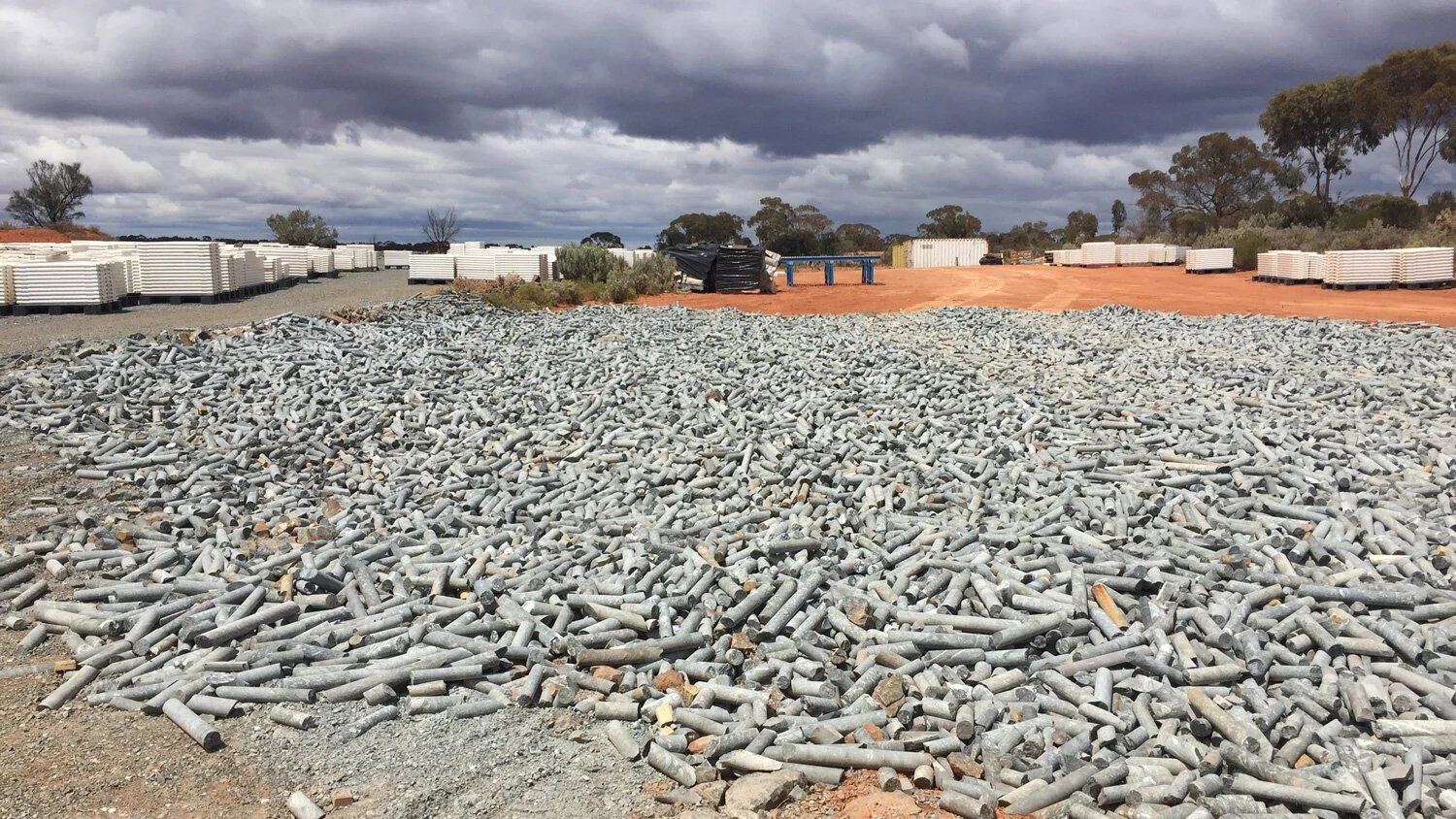
Each year, mineral explorers drill approximately 10 million metres of core, with each metre costing approximately $250 per metre. Each metre represents a wealth of geological information with value today and into the future. Failing to capture that information today results in an enormous lost opportunity for the country as it seeks to secure a new supply of critical minerals. Image: CSIRO.
HyLogger 4 and the National Virtual Core Laboratory (NVCL): digitally preserving drill-core data
Drilling is an essential part of mineral exploration, but it also comes at a cost. Every drill hole is expensive, resource-intensive and leaves an environmental footprint. To minimise impacts on the environment, every drill hole should yield as much information as possible, and once the core reaches the surface, the information needs to be preserved.
Traditionally, drill cores are stored in physical libraries, where samples can deteriorate over time and are accessible only to those who can visit them. By digitally scanning drill cores using new-generation spectral scanner with the HyLogger 4, then preserving the data in the National Virtual Core Library (NVCL), AuScope is ensuring that valuable geological information can be reused to support future research and exploration. Dr Lena Hancock, a Senior Geologist at the Geological Survey of Western Australia, said:
“Before, the mining companies used to waste the drill core. Now, we give them the opportunity to preserve this information, which will be available for the next generation of researchers.”
–Dr Lena Hancock, Senior Geologist at the Geological Survey of Western Australia
Digital preservation of the drill cores also means scientists can avoid drilling new holes to reduce the environmental impact of mineral exploration.
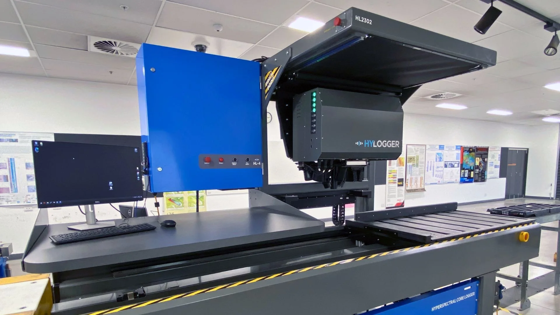
Using reflected light beyond the range of human vision, the HyLogger 4 identifies minerals within drill core quickly and consistently, creating valuable datasets for geoscience research and mineral exploration. Image: Jess Stromberg, CSIRO.
Access drill core scans, hyperspectral datasets from the AuScope NCI NVCL Collection, mineral information through the National Virtual Core Library (NVCL), and practical training resources to help you get started.
Explore the National Virtual Core Library, discover and access mineral data and hyperspectral images using the AuScope Discovery Portal and NCI Data Catalogue, and learn how to use these datasets.
The fourth challenge: How do we explore more efficiently?
Even with advanced instruments and national datasets, there is always room to improve how exploration is carried out. Many prospective regions across Australia are remote, rugged or densely vegetated, making them time-consuming and often dangerous to survey using conventional methods.
The EarthDrone project overcomes these challenges by using drones to survey hard-to-reach areas.
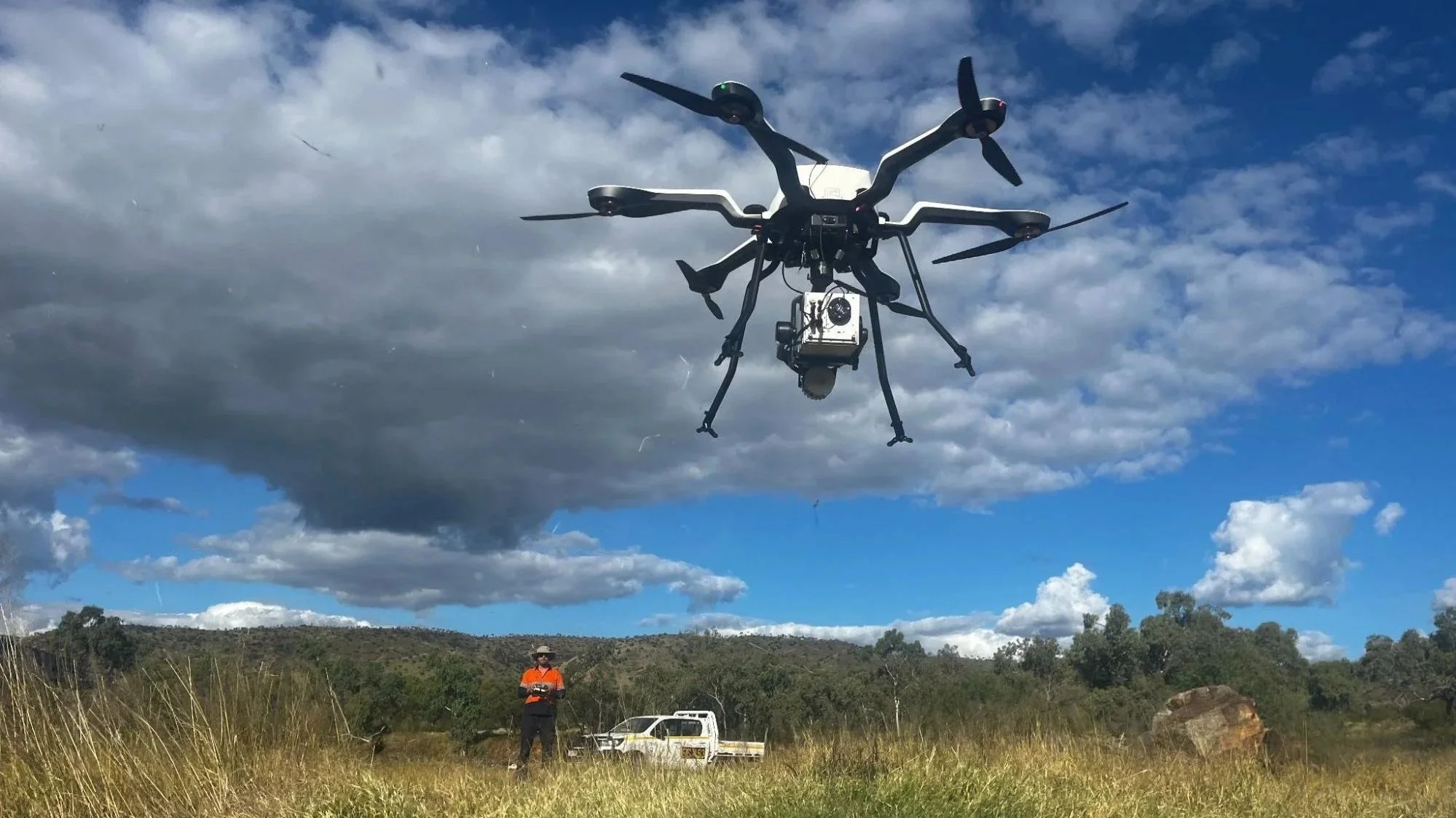
Drone hovering amidst blue skies on a field trip. Image: Steve Mickelthwaite, University of Queensland.
EarthDrone: the next generation of mineral exploration
The drones are equipped with LiDAR, thermal, hyperspectral, Geomagnetic Depth Sounding (GDS) or other sensors, enabling researchers to collect data in remote regions. This can help to comprehensively test regional anomalies at super-high resolution, reduce the human risk, minimise environmental disturbance and accelerate decision making for minerals exploration.
“It is an astonishing time for aerial science. Drone technology, well-proven over the last decade, is now innovating rapidly on sensors and sampling. We are able now to address a range of challenges in critical minerals exploration for research and industry. Our emerging aeromag and ground-deployed gravity surveys have the potential to eliminate the significant human safety concerns engaging manned aircraft surveys.”
– Associate Professor Steve Micklethwaite, EarthDrone Project leader, University of Queensland
Seeing the bigger picture with AuScope
Each of AuScope's capabilities contributes a different piece of the puzzle. Every new instrument, tool and dataset adds another piece to our understanding of how Australia formed and where its critical mineral resources may be found. By investing in research infrastructure that connects these components, AuScope is helping unlock the country’s critical mineral potential and enable the technologies that will define our future.
Find out more about AuScope’s Downwards Looking Telescope – a collective system of instruments, laboratories, data platforms and modelling tools that allows scientists to explore the Earth from its surface to its core.
Key People
Dr Tim Rawling, CEO, AuScope
Dr John O’Donnell, WA Geological Survey
Professor Brent McInness, Director, EarthBank
Dr Lena Hancock, WA Geological Survey
Associate Professor Steve Mickelthwaite, University of Queensland
Professor Dietmar Müller, University of Sydney
Case Study
Australia’s critical minerals are becoming harder to find, but AuScope’s NCRIS-enabled research infrastructure is bringing together the data, tools and technologies needed to help researchers and industry target new deposits more efficiently, while reducing the cost, risk and environmental impact of mineral exploration.
Author
Cintya Dharmayanti, Scientell
Edited by Philomena Manifold
AuScope Programs