
Mapping Australia’s isotope landscape to track people, animals and environmental change

Strontium isotopes act as natural fingerprints, revealing how people, animals and materials move across Australia. Image: AuScope edited Getty Images
A powerful natural tracer for understanding mobility, ecosystem dynamics and environmental change is improving research from environmental and catchment studies, to archaeology, heritage and food provenance. Discover how NCRIS-enabled research is mapping Australia’s isotope landscape.
The Challenge
Tracing the origins and movements of people, animals and materials across landscapes remains a fundamental challenge in environmental science, archaeology and resource management.
Scientists can use strontium isotopes to trace their origins and how they move across landscapes. However, in Australia, this approach has been limited by the lack of a complete, high-resolution map of bioavailable strontium across the continent.
Without this kind of baseline, it is difficult to confidently identify geographic origins, understand past environments, or link environmental signals to the underlying geology.
Building a national isotope capability

Left: Diprotodon molars prepared for analysis. Right: Prof. Anthony Dosseto setting up in-situ isotope analyses at the Wollongong Isotope Geochronology Laboratory (WIGL). Image: University of Wollongong
Researchers at the University of Wollongong’s Isotope Geochronology Laboratory (WIGL) are contributing to the development of a national strontium isotope baseline for Australia.
Using high-precision isotope infrastructure supported through AuScope and NCRIS, the team analyses environmental samples and biological materials to build regional isotope maps for applications ranging from archaeology and palaeoecology to wildlife conservation and food provenance.
Strontium isotopes vary across different rock types and soils and are incorporated into plants, animals and humans through food and water. By measuring strontium isotopes in specimens, and combining that with our strontium isoscape of Australia, we can determine past movements of extinct megafauna marsupials like the Diprotodon, investigating how wide or narrow their ecological niche was, how/if they interacted with other species, and thus re-assess their vulnerability to extinction.
Beyond the fascinating endeavour of exploring the life history of these now-gone giant marsupials, when applying these methods to other species, this has important implications for conservation and the preservation of our rich ecosystems.
The work also supports collaborations across universities, government agencies and museums, and provides training opportunities for students and early-career researchers in advanced isotope geochemistry.
Mapping Australia’s isotope landscape
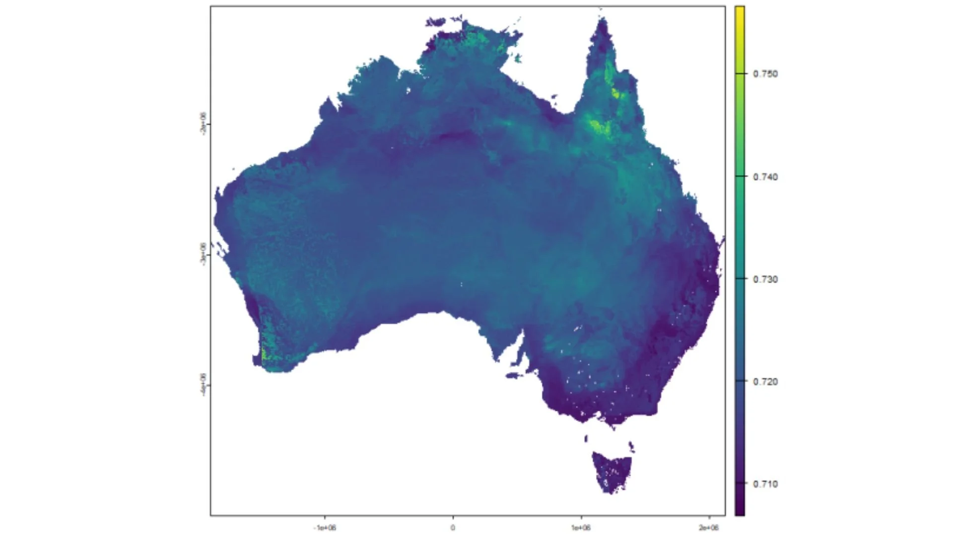
A strontium isotope map (or isoscape) of Australia, where colours reveal the isotope composition of bioavailable strontium, a key tool to trace animal and materials movements. Yellow highlights high values, while purple shows lower values. Image: Adapted from Dosseto et al. (2025), Earth System Science Data, DOI.
The team has produced the first bioavailable strontium isoscape for Australia, based on environmental samples compiled across the continent. Several datasets from this work have been published in Earth System Science Data and are available as open-access resources.
“Strontium isotopes provide a natural fingerprint of the landscape. By mapping these signals across Australia, we can start to track movement—whether it’s ancient animals, modern wildlife, or even food products—in ways that were not previously possible.”
– Professor Anthony Dosseto, University of Wollongong
From data to real world impact
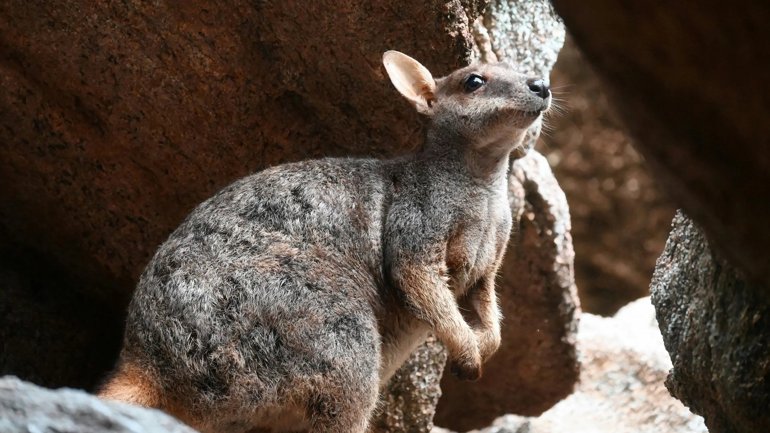
Fossils reveal rock-wallabies were once wanderers, Australian Geographic, 2026. Image: Enguerrand Photography
These datasets underpin a range of applications and collaborations, including:
Archaeology and palaeoecology
Strontium isotopes in fossil teeth are being used to reconstruct the mobility and ecology of extinct fauna, including Australian megafauna. Recent studies have revealed niche partitioning in Middle Pleistocene kangaroos (Quaternary Science Reviews, 2026) and assessed the foraging range of extinct macropodids (PLOS ONE, 2025), while broader applications are gaining national attention (Australian Geographic, 2026).
Environmental and catchment studies
Isotope signatures in river sediments and soils are linking geological sources to landscape processes. This approach is improving understanding of sediment residence times and environmental change, including recent work in the Gulf of Carpentaria and southeast Australia (Quaternary Science Reviews, 2025) and tracking past fire severity and intensity (Quaternary Science Reviews, 2025).
Heritage and provenance research
Researchers are using isotopic signatures to identify the geographic origin of archaeological remains and cultural materials. Applications include fossil dental calculus studies (Journal of Archaeological Method and Theory, 2024) and multi-proxy analysis of human remains in New South Wales (Archaeometry, 2026).
Food provenance and material industries
Strontium isotope “fingerprints” can support the traceability and authentication of agricultural products and raw materials. This is an established application internationally (Eur Food Res Technol, 2016) and is being applied in Australian research and industry, with strong potential for expansion.
“Having a national isotope baseline transforms what we can do with these tools. It moves us from isolated studies to a coordinated framework that supports research, industry and government applications”
– Professor Anthony Dosseto, University of Wollongong
Translation and future work
The team is collaborating with EarthBank to develop a strontium isotope data model for integration into national spatial platforms. This will help make these datasets more easily discoverable and interoperable within Australia’s open geoscience data infrastructure.
Future work will expand geographic coverage, integrate additional isotope systems, and support applications in environmental monitoring, cultural heritage, agriculture and health.
National infrastructure enabling this research
This research was delivered through AuScope NCRIS infrastructure, including:
High-precision multi-collector ICP-MS instrumentation for isotope ratio measurements
Sample preparation and clean laboratory facilities for trace element geochemistry
National data infrastructure supporting open-access isotope datasets
Collaborative frameworks linking universities, government agencies and industry
AuScope has also played a key role in facilitating national collaboration, enabling integration of datasets and supporting the development of shared analytical standards
Key People and Organisations
Wollongong Isotope Geochronology Laboratory (WIGL)
Prof. Anthony Dosseto - Director - Wollongong Isotope Geochronology Laboratory, University of Wollongong
Dr Florian Dux - Earthbank data scientist - Wollongong Isotope Geochronology Laboratory, University of Wollongong
Contact Information
Provide contact details for project researchers who may have further inquiries.
Professor Anthony Dosseto
Wollongong Isotope Geochronology Laboratory (WIGL)
University of Wollongong
Email: tonyd@uow.edu.au
Case Study
NCRIS-enabled research at the University of Wollongong is mapping Australia’s strontium isotope landscape to track movement of people, animals and materials, enabling applications from archaeology to food provenance.
Author
Professor Anthony Dosseto, University of Wollongong
Edited by Philomena Manifold, AuScope
Further information
Wollongong Isotope Geochronology Laboratory (WIGL)
PEER-REVIEWED PAPERS
A bioavailable strontium isoscape of Australia. Earth System Science Data, 2025
A strontium isoscape of southwestern Australia and progress toward a national strontium isoscape. Earth System Science Data, 2025
A strontium isoscape of northern Australia. Earth System Science Data, 2023
A strontium isoscape of inland southeastern Australia. Earth System Science Data, 2022
IN THE MEDIA
Fossils reveal rock-wallabies were once wanderers, Australian Geographic, 2026

