
Geochemical Imaging Community
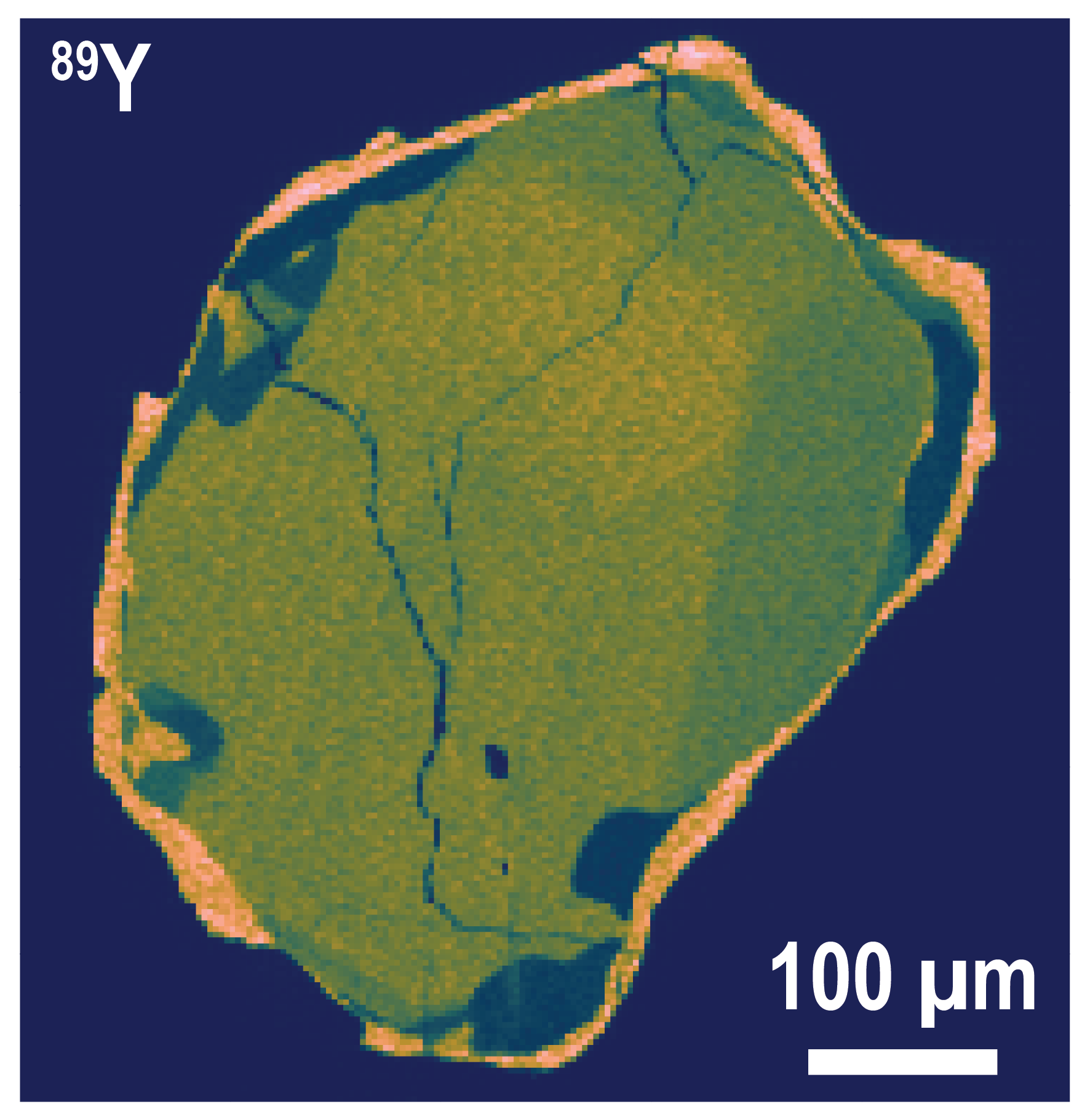
Image of a leucosome-hosted monazite from the Challenger gold mine in the Gawler Craton mapped with a time-of-flight laser ablation ICP-MS instrument at Adelaide University. A thin, high-Y rim mantles an earlier sector zoned core with irregular low-Y domains at the core-rim interface. Image: Alex De Vries Van Leeuwen.
About us
Geochemical imaging is becoming an increasingly crucial tool in geochemistry and geochronology studies, able to replace or provide spatial context for detailed point-measurements. Some geochemical imaging techniques, such as scanning electron microscopy (SEM), cathodoluminescence (CL), and automated mineralogy are widely used across Australian and international universities, while others including elemental and geochronology mapping by laser ablation, and Raman spectroscopy mapping, are less commonly available. As part of the AuScope Geochemistry Network (AGN), the geochemical imaging community brings together researchers from across Australia to enable training, discussion and sharing of experience and tools for improving the understanding and availability of imaging techniques for geochemistry.
Overview
The AGN geochemical imaging community provides a forum for participants to discuss imaging techniques, applications and advancements, as well as to advertise resources such as workshops, webinars and training sessions. The community also contains targeted working groups focussed on more specific imaging methods or projects. These working groups are open to researchers across Australia, and the community welcomes new proposals for working groups that advance geochemical imaging expertise or resources.
“Geology studies the world across incredibly broad resolutions - from tiny grains and even the chemical bonds within minerals, to tectonic plates and the Earth or even other planetary bodies. Imaging is vital for translating measurements made at micro or even nanoscale to real world applications.” - Dr Angus Nixon
Resources
Presentations from the AuScope EarthBank Workshop on Geochemical, Geochronological and Mineralogical Imaging and Laser Raman held at the University of Tasmania on 4-6th of August 2026:
Projects
LA-ICP-MS Mapping
Laser ablation ICP-MS imaging is a powerful tool for resolving geochemistry and geochronology of rocks and minerals, providing spatial context to measurements. Minerals and mineral assemblages often exhibit elemental, isotopic and age zonation or heterogeneity which can often reflect geological processes and other information crucial for understanding of the system. Mapping requires ablating and stitching transects across an area or mineral of interest to create spatial geochemical maps and reveal context beyond traditional point-sampling beam methods. This working group is focussed on discussing and advancing laser ablation ICP-MS mapping methodology and data processing approaches to improve geochemical mapping reliability and interpretation.
Contact: jeffrey.oalmann@utas.edu.au
Coupling StraboMicro and EarthBank
Developed by the StraboSpot team, StraboMicro is an open desktop or browser application for managing and nesting hierarchical microstructural images, from thin-section to micro-scales. The EarthBank platform continues to be developed with the support of the National Collaborative Research Infrastructure Strategy (NCRIS) and AuScope, with specific applications for storing and reusing various geochemical data types, including U-Pb, Lu-Hf geochronology, isotopic ratios and elemental abundance measurements. This project is working to connect spatial and image data managed in StraboMicro to geochemistry measurements stored in EarthBank, to create a complementary ecosystem for interpreting spatial geochemistry data.
Contact: sebastien.meffre@utas.edu.au
Laser Raman Spectroscopy
Raman spectroscopy is a flexible, non-destructive technique that can be applied to a wide range of materials, including minerals, alloys and liquids. This approach is generally used as a qualitative tool for identifying mineral species, including between polymorph phases, and can be applied either as point-analyses or mapped across an area of interest. As the Raman response is sensitive to crystal structure, zoning can be mapped based on crystallinity, crystal orientation or trace elements. Confocal systems can also be used to target fluid or mineral inclusions within a host phase. With correct calibration, quantitative or semi-quantitative work can be undertaken, opening opportunities for thermochronology and crystallographic applications. This working group focuses on training and troubleshooting for geochemists interested in applying Raman spectroscopy for their research, as well as identifying requirements to grow the user community, such as reference materials, data processing, or other community needs.
Contact: angus.nixon@adelaide.edu.au
Coming Soon
Optical Microscopy
Scanning Electron Microscope Mineralogy
Electron Microprobe Mapping
COMMUNITY NAME
Geochemical Imaging Community
WORKING GROUP LEADS
Dr Allan Gomes, University of Tasmania
Dr Angus Nixon, Adelaide University
FOCUS AREAS / APPLICATIONS
Geochemistry, Geochemical Imaging
AUSCOPE PROGRAMS