ANSIR: Research Facilities For Earth Sounding

 
ANSIR Logo
An Ocean Bottom Seismographs being deployed from the RV Investigator in 2016. Image: Marine National Facility via Geoscience Australia.

An Ocean Bottom Seismographs being deployed from the RV Investigator in 2016. Image: Marine National Facility via Geoscience Australia.


ANSIR is a partnership of universities and government agencies in Australia and New Zealand that provides researchers with equipment and services for earth imaging across Australasia.


Equipment & Services

Discover our range of Earth imaging and sounding equipment and services including, equipment support, training, and operation:

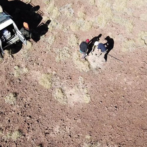
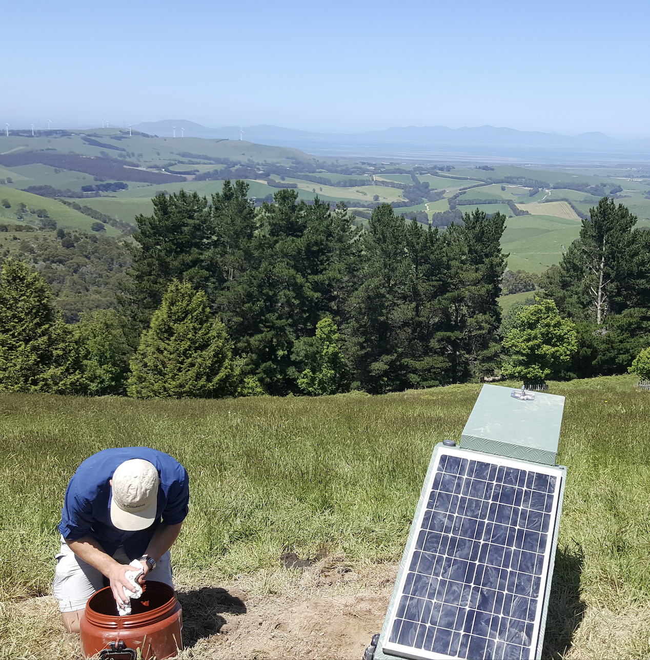
  • Passive seismic equipment, including short-period and broadband three-component seismometers, high-fidelity solar-powered data loggers, and portable “all-in-one” seismic nodes.

    These are based at the Australian National University. Please check instrument availability here and contact Santiago Velasquez for more information.

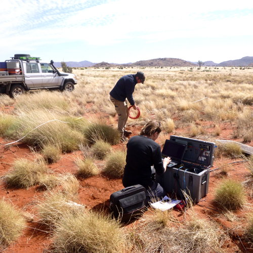
  • Portable electromagnetic equipment including 25 Earth data logger long-period MT sets; 20 LEMI-424 long-period MT sets; up to 25 LEMI-423 broadband MT sets; and 5 Phoenix MTU-5C ultra-broadband MT sets. 5 licences of Geotools (CGG), 5 licences of EMPower (Phoenix) and (TBA) access to CGG 3D MT Inversion software.

    These are based at the University of Adelaide. Please contact Prof Graham Heinson for more information.

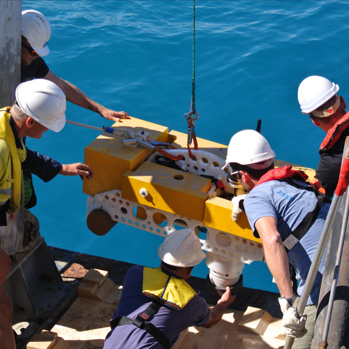
  • Equipment includes 5 sets of Guralp ‘Liber’ and 2 Nanometrics ‘Abalone’ broadband ocean bottom seismometers (OBS). Users must be able to support trained technical personnel and have scientific personnel with prior OBS experience on hand. Ship-time and insurance of the equipment while in transit and on the seafloor is the responsibility of the proponents of experiments.

    These are based at the Research School of Earth Science, Australian National University. Please check instrument availability here.

    Contact Santiago Velasquez for more information.

  • Portable petrophysical equipment, including downhole seismic equipment and earthquake aftershock recorders.

    These are hosted at AuScope’s Subsurface Observatory at The University of Melbourne. Please contact Dr Dan Sandiford for more information.

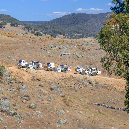
  • ANSIR is able to arrange reflection experiments for a wide variety of project goals, survey parameters, logistics, permitting and licensing requirements and consequent equipment requirements.

    These are based at Geoscience Australia. Please contact Marina Costelloe or Donna Cathro for more information.


Please note: demand for equipment & services is increasing, so please apply well ahead of your project timeline and consult with the scientific coordinators listed above.


Background

ANSIR was originally created as a Major National Research Facility in 1997 by Geoscience Australia and The Australian National University to encourage and assist world-class research and education in the field of seismic imaging of the Earth. In 2008 the University Of Adelaide joined with support for electromagnetic research. 

Since 2007 ANSIR has operated in conjunction with the Earth Imaging component of the AuScope facility established under the NCRIS scheme. From 2011 further AuScope investment from the AGOS EIF program has provided additional equipment. ANSIR has received investment from ANU, MNRF, ARC LIEF over the years.

Equipment from ANSIR Facilities is available to all researchers on the basis of merit and instrumentation availability, as judged by the ANSIR Access Committee on the basis of a short proposal. Researchers have to meet the project operating costs and a modest mobilisation fee. Training is provided in the use of the portable equipment.

Applicants for access to ANSIR equipment and services should contact the appropriate Scientific Coordinators to first discuss their needs for prospective projects, and then prepare a formal proposal, which is submitted to the AuScope National Geophysics Program Manager, Dr Ben Kay.


SITE NAVIGATION
ANSIR Home
ANSIR Instrumentation & Scheduling
ANSIR Online Application
ANSIR Project Performance Report
ANSIR Acknowledgment
ANSIR Terms and Conditions


KEY CONTACTS
AuScope National Geophysics
Program Manager:
Dr Ben Kay


SCIENTIFIC COORDINATORS

For portable seismic and OBS experiments: Santiago Velasquez,
Australian National Uni 

For electromagnetic experiments:
Prof Graham Heinson, Adelaide Uni

For petrophysical experiments:
Dr Dan Sandiford, Melbourne Uni

For reflection seismic services:
Marina Costelloe and Donna Cathro
Geoscience Australia

ANSIR PARTNERS
Geoscience Australia, AuScope, CSIRO, Australian National Uni, Uni of Adelaide, Uni of Melbourne, Uni of TAS, Uni of WA, Macquarie Uni, Uni of Auckland & Victoria Uni (Wellington).

ANSIR: Instrumentation and Scheduling

 
ANSIR Logo

Seismic Recorders
3 instrument types
ANU TerraSAWR
66 instruments (23 under maintenance)
ANU LPR200 (AUS)
167 instruments (24 under maintenance)
ANU LPR200 (NZ)
26 instruments (0 under maintenance)
Seismometers
5 instrument types
Nanometrics Trillium Compact 120s (AUS)
120 instruments (1 under maintenance)
Nanometrics Trillium Compact 120s (NZ)
5 instruments (0 under maintenance)
Nanometrics Trillium Compact Horizon 120s
12 instruments (0 under maintenance)
Nanometrics Trillium Compact Posthole 120s
35 instruments (0 under maintenance)
Nanometrics Trillium Compact 20s
30 instruments (0 under maintenance)
Short-Period Seismometers
3 instrument types
LE-3D Lite (AUS)
90 instruments (0 under maintenance)
LE-3D Lite (NZ)
25 instruments (0 under maintenance)
Sercel L28-3D
18 instruments (0 under maintenance)
Nodal Seismometers
3 instrument types
IGU-16HR 3C 5Hz (AUS)
215 instruments (0 under maintenance)
IGU-16HR 3C 5Hz (NZ)
111 instruments (0 under maintenance)
IGU-BD 3C 5s
99 instruments (0 under maintenance)
Fibre Optic DAS
3 instrument types
Silixa iDAS 24
1 instrument (0 under maintenance)
Silixa iDAS 25
1 instrument (0 under maintenance)
Silixa iDAS 25 (NZ)
1 instrument (0 under maintenance)
Magnetotellurics
4 instrument types
MTU-5C
9 instruments (0 under maintenance)
EDL
24 instruments (0 under maintenance)
LEMI-424
20 instruments (0 under maintenance)
LEMI-423
23 instruments (0 under maintenance)

(last updated 20 June 2025)


Please note: demand for equipment & services is increasing, so please apply well ahead of your project timeline and consult with the scientific coordinators listed above.


SITE NAVIGATION
ANSIR Home
ANSIR Instrumentation & Scheduling
ANSIR Online Application
ANSIR Project Performance Report
ANSIR Acknowledgment
ANSIR Terms and Conditions


KEY CONTACTS
AuScope National Geophysics
Program Manager:
Dr Ben Kay


SCIENTIFIC COORDINATORS

For portable seismic and OBS experiments: Santiago Velasquez,
Australian National Uni 

For electromagnetic experiments:
Prof Graham Heinson, Adelaide Uni

For petrophysical experiments:
Dr Dan Sandiford, Melbourne Uni

For reflection seismic services:
Marina Costelloe and Donna Cathro
Geoscience Australia

ANSIR PARTNERS
Geoscience Australia, AuScope, CSIRO, Australian National Uni, Uni of Adelaide, Uni of Melbourne, Uni of TAS, Uni of WA, Macquarie Uni, Uni of Auckland & Victoria Uni (Wellington).

ANSIR: Terms and Conditions


This page contains details about application eligibility and procedure for access to ANSIR equipment and services, along with terms and conditions of use. If you need more information, please contact the AuScope National Geophysics Program Manager, Dr Ben Kay.


Plain Language Summary

This summary explains what you need to know before applying to use ANSIR equipment or services:

  • Who can apply? ANSIR equipment and services are available to researchers from Australian and international universities, publicly funded research organisations, and industry partners. Due to high demand, access is prioritised based on scientific merit. The lead applicant, known as the Principal Investigator (PI), is responsible for coordinating the project and meeting all related obligations.

  • What can you borrow? You can request access to passive seismic sensors, active-source seismic gear, magnetotelluric (MT) instruments, distributed acoustic sensing (DAS), and petrophysical tools (field or lab-based).

  • How do you apply? Speak with a Scientific Coordinator before applying. Complete the online application form. Your proposal will be reviewed by the ANSIR Access Committee.

  • When should you apply? Applications are accepted year-round and processed as received. Some instruments are in high demand, so apply as early as possible to improve your chances of securing the equipment you need

  • What are your responsibilities? PIs must provide accurate information, confirm training needs, and cover all project costs, including freight, consumables, logistics, insurance, and mobilisation. Users must clean and repack all equipment before return and submit data and reports on time..

  • What does it cost? You must pay for mobilisation, transport, consumables, and equipment insurance. Specific cost details vary depending on the ANSIR Facility providing the equipment.

  • What about data? Data and metadata must be submitted to national repositories (e.g., AusPass, NCI) within six months of project completion. Public access is required unless an embargo is approved. Projects must follow FAIR and CARE principles and use ISO 19115-1:2014 metadata standards.

  • What happens after approval? If your project is approved, your institution must sign a formal Project Agreement with the relevant ANSIR Facility before any equipment can be released. This agreement confirms responsibilities for logistics, insurance, and data compliance.


Online Application Form

Applications to access ANSIR facilities must now be made through our online application form. Click the link below to submit your application.


Terms & conditions

The following Terms and Conditions govern the use of equipment, services, and support provided by the ANSIR Research Facility for Earth Sounding. By submitting an application and participating in an ANSIR-supported project, the Principal Investigator (PI) and affiliated institutions agree to the following:

1. Eligibility and Access

  • Access is open to:

    • Researchers based at Australian or international academic institutions;

    • Publicly funded research organisations (e.g., GA, CSIRO; State Geological Surveys);

    • Industry users, subject to partnership agreements or fee-based models.

  • Applications are accepted year-round and assessed on:

    • Scientific merit by the ANSIR Access Committee;

    • Instrument availability;

    • Alignment with national research priorities.

  • Users must meet all project operating costs, including insurance and mobilisation fees endorsed by the ANSIR Steering Committee.

  • All applicants must consult with the relevant Scientific Coordinator prior to submission.

  • Successful applicants must sign a Project Agreement between their institution and the ANSIR equipment provider. No equipment will be released until this agreement is executed.

2. Application Requirements

  • All applications must be submitted through the online ANSIR Application Form. This includes details on:

    • Project title and scientific objectives

    • Field crew experience and co-applicants

    • Equipment request and deployment design

    • Funding, timing, and expected data outputs

  • Applicants should review the current ANSIR Online Application Form at for the full list of fields and file uploads required. Consultation with a Scientific Coordinator is mandatory prior to submission.

3. Equipment Use and Responsibilities

  • Principle Investigators are responsible for:

    • All project-related costs (e.g. consumables, customs, all logistics and fieldwork);

    • Providing adequate insurance for the equipment;

    • Ensuring trained personnel handle ANSIR equipment;

    • Transporting, deploying, and returning equipment in original working order.

  • Equipment must be returned:

    • Clean, dry, and packed using original materials;

    • In ready-to-use condition;

    • With completed handover and metadata forms.

  • Borrowers are liable for:

    • Repair or replacement costs due to damage or loss;

    • Minimum liability set at 10% of equipment value;

    • Full replacement cost for total loss or severe damage, adjusted by depreciation.

  • Overseas users must manage all customs/export/import procedures. ANSIR does not act as exporter of record.

  • All equipment must be inspected before field deployment. Faults or missing items must be reported immediately.

4. Training and Support

  • ANSIR may provide training or deployment support, subject to availability.

  • Users must declare training needs in the application.

  • On-site or remote support may be offered for new users or international teams.

  • Applicants are encouraged to make arrangements for training early through the relevant Scientific Coordinators.

5. Data Management and Embargo Policy

  • All data generated through ANSIR-supported projects must be managed in accordance with the FAIR (Findable, Accessible, Interoperable, Reusable) and CARE (Collective Benefit, Authority to Control, Responsibility, Ethics) principles.

  • In compliance with national and international best practices, all data must:

    • Be stored in an openly accessible repository;

    • Include metadata that, at a minimum, follows ISO 19115-1:2014 standards, specifically: Identifier, Creator, Title, Publisher, Funder, Publication Year, Resource Type, and License;

    • Be documented throughout the project lifecycle, from creation through to publication, where reasonably possible.

  • Data and metadata must be submitted within 6 months of project completion to:

    • AusPass (passive seismic);

    • NCI (magnetotelluric);

    • Other appropriate national repositories for DAS or petrophysical data.

  • Metadata must include:

    • Digital field logs (PDF, CSV, or XLSX);

    • Instrument serial numbers, station coordinates and elevations;

    • Deployment configuration and any setup deviations;

    • Deployment dates.

  • Embargoes up to 2 years are allowed for publication or commercial sensitivity. Requests must be documented in the application.

  • Projects conducted on Indigenous lands must demonstrate appropriate consultation and Indigenous data governance aligned with CARE principles.

  • FDSN network codes are required for passive seismic projects. DOIs are encouraged for discoverability.

6. Reporting Requirements

  • A Project Performance Report (PPR) must be submitted within 14 business days of equipment return, using the ANSIR online form.

  • The PPR collects feedback on:

    • Equipment used, number of stations, and project duration;

    • Logistics, support, and training experience;

    • Equipment performance, data quality, and handling;

    • Technical issues encountered;

    • Outputs and acknowledgements;

    • User experience and suggestions for improvement;

    • Project impact, collaborations, and engagement.

  • Optional: Users may upload photos and captions for outreach purposes with consent.

  • The PI is responsible for timely and complete submission. Failure to do so may result in restricted access to future ANSIR equipment and services.

7. Publications and Acknowledgements

  • All outputs resulting from ANSIR-supported work must:

    • Acknowledge ANSIR support;

    • Include the ANSIR project loan number.

  • The ANSIR logo may be used in presentations

  • Open access publication is encouraged.

  • See the ANSIR Acknowledgement page for publication ready examples.

8. Institutional Responsibilities

  • Institutions must:

    • Approve the application prior to submission;

    • Accept insurance and mobilisation responsibilities under the Project Agreement;

    • Nominate a legal or administrative contact.

  • The signed Project Agreement is a prerequisite for equipment dispatch.

  • Institutions must ensure all data obligations are met.

9. Legal and Governance Provisions

  • ANSIR accepts no liability for:

    • Suitability of instruments for specific scientific aims;

    • Accuracy of measured data;

    • Losses due to unforeseen equipment failure or delays.

  • Disputes will be managed per the ANSIR Agreement’s dispute resolution process. Unresolved matters may be referred to arbitration in the ACT.

10. Acceptance

  • By submitting an application:

    • The PI confirms all information is complete and accurate;

    • The PI agrees to these Terms and Conditions;

    • Institutional approval is confirmed;

    • The PI agrees to enter into a Project Agreement if the application is approved.

Version: March 2025


SITE NAVIGATION
ANSIR Home
ANSIR Instrumentation & Scheduling
ANSIR Online Application
ANSIR Project Performance Report
ANSIR Acknowledgment
ANSIR Terms and Conditions


KEY CONTACTS
AuScope National Geophysics
Program Manager:
Dr Ben Kay


SCIENTIFIC COORDINATORS

For portable seismic and OBS experiments: Santiago Velasquez,
Australian National Uni 

For electromagnetic experiments:
Prof Graham Heinson, Adelaide Uni

For petrophysical experiments:
Dr Dan Sandiford, Melbourne Uni

For reflection seismic services:
Marina Costelloe and Donna Cathro
Geoscience Australia

ANSIR: Acknowledgements


Every cross-correlation, resistivity model, seismic trace and core analysis supported by ANSIR tells a story but it also builds a case. Your acknowledgements help demonstrate the impact of Australia’s nationally coordinated geoscience infrastructure.

They’re key to securing ongoing NCRIS support for the instruments, data systems, and people that make Earth science research possible.


General Use (Journal Articles, Reports, Datasets)

“This research was supported by ANSIR - Research Facility for Earth Sounding, enabled by AuScope and the Australian Government via the National Collaborative Research Infrastructure Strategy (NCRIS). Equipment used in this study was funded and provided by AuScope through the ANSIR network (Project Loan #[ANSIR Project ID]).”

Facility-Specific (Extended Format)

“We acknowledge the [Facility Name] at [Institution], a contributing partner to ANSIR - Research Facility for Earth Sounding. Equipment for this project was enabled by AuScope through the ANSIR network and supported by the Australian Government via the National Collaborative Research Infrastructure Strategy (NCRIS).”


Your data moves the Earth, your acknowledgements keep it going.


Data Availability Statements & Citations

  • Passive Seismic (via AusPass and NCI) - Two-year Embargo:

This project used [insert ANSIR instrumentation here] from the ANSIR - Research Facility for Earth Sounding national pool, enabled by AuScope and the Australian Government via NCRIS. Seismic waveform data from this project will be made publicly available via the Australian Passive Seismic Server (AusPass; https://auspass.edu.au), under FDSN network code [FDSN Network Code]. Raw data from this project will be made publicly available via National Computational Infrastructure (NCI Australia; DOI: [insert NCI DOI here]). Data will be released in [Year] following the two-year embargo. The network is registered under the FDSN as [FDSN Network Code] in [Year] (DOI: [insert DOI here]; [insert FDSN network page here]).


  • Passive Seismic (via AusPass and NCI) - Open:

This project used [insert ANSIR instrumentation here] from the ANSIR - Research Facility for Earth Sounding national pool, enabled by AuScope and the Australian Government via NCRIS. Seismic waveform data from this project will be made publicly available via the Australian Passive Seismic Server (AusPass; https://auspass.edu.au), under FDSN network code [FDSN Network Code]. Raw data from this project will be made publicly available via National Computational Infrastructure (NCI Australia; DOI: [insert NCI DOI here]). The network is registered under the FDSN as [FDSN Network Code] in [Year] (DOI: [insert DOI here]; [insert FDSN network page here]).


Include FDSN network codes and full references, as shown in:

Marignier, A., Eakin, C., Hejrani, B., Agrawal, S., and Hassan, R. (2024). Sediment thickness across Australia from passive seismic methods. Geophysical Journal International, 237(2), 849–861. https://doi.org/10.1093/gji/ggae070


  • Magnetotelluric (via NCI):

This project used [insert ANSIR instrumentation here] from the ANSIR - Research Facility for Earth Sounding national pool, enabled by AuScope and the Australian Government via NCRIS. Magnetotelluric ‘Level-0’ and ‘Level-1’ time-series data are archived at the National Computational Infrastructure (NCI Australia; DOI: [insert NCI DOI here]).

  • DAS (via NCI):

This project used [insert ANSIR instrumentation here] from the ANSIR - Research Facility for Earth Sounding national pool, enabled by AuScope and the Australian Government via NCRIS. Raw data from this project will be made publicly available via National Computational Infrastructure (NCI Australia; DOI: [insert NCI DOI here]).


SITE NAVIGATION
ANSIR Home
ANSIR Instrumentation & Scheduling
ANSIR Online Application
ANSIR Project Performance Report
ANSIR Acknowledgment
ANSIR Terms and Conditions


KEY CONTACTS
AuScope National Geophysics
Program Manager:
Dr Ben Kay


SCIENTIFIC COORDINATORS

For portable seismic and OBS experiments: Santiago Velasquez,
Australian National Uni 

For electromagnetic experiments:
Prof Graham Heinson, Adelaide Uni

For petrophysical experiments:
Dr Dan Sandiford, Melbourne Uni

For reflection seismic services:
Marina Costelloe and Donna Cathro
Geoscience Australia

ANSIR: Online Application Form


This page contains the online form to request an equipment loan from the ANSIR Research Facilities for Earth Sounding. If you need more information, please contact the AuScope National Geophysics Program Manager, Dr Ben Kay.


SITE NAVIGATION
ANSIR Home
ANSIR Instrumentation & Scheduling
ANSIR Online Application
ANSIR Project Performance Report
ANSIR Acknowledgment
ANSIR Terms and Conditions


KEY CONTACTS
AuScope National Geophysics
Program Manager:
Dr Ben Kay


SCIENTIFIC COORDINATORS

For portable seismic and OBS experiments: Santiago Velasquez,
Australian National Uni 

For electromagnetic experiments:
Prof Graham Heinson, Adelaide Uni

For petrophysical experiments:
Dr Dan Sandiford, Melbourne Uni

For reflection seismic services:
Marina Costelloe and Donna Cathro
Geoscience Australia

ANSIR: Project Performance Report


This page contains the form for completing the ANSIR Project Performance Report, which must be submitted within two weeks of returning ANSIR equipment.

This report helps us evaluate and improve the service, equipment, and support offered by the ANSIR Research Facilities for Earth Sounding.

If you need more information, please contact the AuScope National Geophysics Program Manager, Dr Ben Kay.


SITE NAVIGATION
ANSIR Home
ANSIR Instrumentation & Scheduling
ANSIR Online Application
ANSIR Project Performance Report
ANSIR Acknowledgment
ANSIR Terms and Conditions


KEY CONTACTS
AuScope National Geophysics
Program Manager:
Dr Ben Kay


SCIENTIFIC COORDINATORS

For portable seismic and OBS experiments: Santiago Velasquez,
Australian National Uni 

For electromagnetic experiments:
Prof Graham Heinson, Adelaide Uni

For petrophysical experiments:
Dr Dan Sandiford, Melbourne Uni

For reflection seismic services:
Marina Costelloe and Donna Cathro
Geoscience Australia

A partnership of universities and government agencies providing researchers with world-class equipment and services for earth imaging across Australasia since 1997.

ANSIR - National Research Facility for Earth Sounding

Equipment & Services

Discover our comprehensive range of Earth imaging and sounding equipment, including equipment support, training, and operational services for researchers across Australasia.

Passive Seismic Equipment

50 broadband seismometer sets, 120 LPR-200 recorders, short-period and broadband three-component seismometers, high-fidelity solar-powered data loggers, and portable "all-in-one" seismic nodes.

Australian National University Check Availability

Electromagnetic Equipment

25 Earth data logger long-period MT sets, 20 LEMI-424 long-period MT sets, up to 25 LEMI-423 broadband MT sets, and 5 Phoenix MTU-5C ultra-broadband MT sets. Includes Geotools, EMPower licenses and 3D MT Inversion software.

University of Adelaide Contact Coordinator

Ocean Bottom Seismometers

5 sets of Guralp 'Liber' and 2 Nanometrics 'Abalone' broadband ocean bottom seismometers (OBS) for marine seismic studies. Requires trained technical personnel and prior OBS experience.

Australian National University Check Schedule

Petrophysical Equipment

Portable petrophysical equipment including downhole seismic equipment and earthquake aftershock recorders for comprehensive subsurface studies and monitoring.

University of Melbourne Contact Coordinator

Reflection Seismic Services

Complete reflection seismic experiments tailored to project goals, including survey design, logistics planning, permitting assistance, and equipment coordination.

Geoscience Australia Contact Coordinators
⚠️ Planning Advisory: Demand for equipment and services is increasing significantly. Please apply well ahead of your project timeline and consult with the appropriate scientific coordinators to ensure availability.

Application Process

ANSIR equipment is available to all researchers based on merit and availability, as determined by the ANSIR Access Committee. Training is provided for all portable equipment.

1
Initial Consultation
Contact the appropriate Scientific Coordinator to discuss your project needs and requirements
2
Formal Proposal
Prepare and submit a detailed proposal through our online application system
3
Committee Review
ANSIR Access Committee evaluates your proposal based on scientific merit and feasibility
4
Training & Deployment
Receive equipment training and coordinate logistics for your field campaign
5
Project Execution
Deploy equipment following safety protocols and standard operating procedures
6
Reporting
Submit project performance reports and contribute to the research community
7
Confirmations

Background & History

ANSIR was originally created as a Major National Research Facility in 1997 by Geoscience Australia and The Australian National University to encourage and assist world-class research and education in the field of seismic imaging of the Earth. In 2008 the University Of Adelaide joined with support for electromagnetic research.

Since 2007 ANSIR has operated in conjunction with the Earth Imaging component of the AuScope facility established under the NCRIS scheme. From 2011 further AuScope investment from the AGOS EIF program has provided additional equipment. ANSIR has received investment from ANU, MNRF, ARC LIEF over the years.

Equipment from ANSIR Facilities is available to all researchers on the basis of merit and instrumentation availability, as judged by the ANSIR Access Committee on the basis of a short proposal. Researchers have to meet the project operating costs and a modest mobilisation fee. Training is provided in the use of the portable equipment.

Applicants for access to ANSIR equipment and services should contact the appropriate Scientific Coordinators to first discuss their needs for prospective projects, and then prepare a formal proposal, which is submitted to the AuScope National Geophysics Program Manager, Dr Ben Kay.

Scientific Coordinators

Seismic & OBS Coordinator

Santiago Velasquez

Australian National University

ansir@anu.edu.au

Electromagnetic Coordinator

Prof Graham Heinson

University of Adelaide

Graham.Heinson@adelaide.edu.au

Petrophysical Coordinator

Dr Dan Sandiford

University of Melbourne

dsand@unimelb.edu.au

Reflection Seismic Coordinators

Marina Costelloe & Donna Cathro

Geoscience Australia

marina.costelloe@ga.gov.au

donna.cathro@ga.gov.au

Geophysics Program Manager

Dr Ben Kay

AuScope National Geophysics Program Manager

ben@auscope.org.au

ANSIR Partners

A collaborative network of leading research institutions

Geoscience Australia
AuScope
CSIRO
Australian National University
University of Adelaide
University of Melbourne
University of Tasmania
University of Western Australia
Macquarie University
University of Auckland
Victoria University Wellington

ANSIR - Australian National Seismic Imaging Resource

Enabling world-class research in Earth imaging since 1997

For more information visit: www.auscope.org.au/ansir

1
Principal Investigator
2
Project Details
3
Project Timeline
4
Instrument Selection
5
Logistics
6
Data Management
7
Confirmations
8
Review & Submit

Principal Investigator

Contact information for the project lead

Co-Applicants

Add co-applicants for your project (optional)

Project Details

Basic information about your research project

📍 Coordinate Requirements: Latitude/longitude coordinates are required for FDSN DOI minting and data archiving. You can either draw a polygon on the map below or manually enter coordinates.

Coordinate Input

Project Timeline

Define your project dates to check instrument availability

📅 Real-time Availability: Once you select your project dates, the instrument availability will be automatically updated to show the true number of instruments available during your requested timeframe, accounting for instruments currently on loan to other experiments.

Approximate size (e.g. 500 GB), number of stations, and total deployment duration (e.g. 6 weeks, 30 stations).

Check all that apply:

Instrument Selection

Select the instruments you require for your project. Availability is based on your selected timeline.

Logistics

Field team experience, training requirements, and operational considerations

Describe the experience of users listed in this application specifically with the requested instruments. Include roles, approximate dates, and prior deployments. ANSIR may request further details or require training before equipment is issued.

ANSIR may require training or supervision before equipment is issued, particularly for overseas deployments or first-time users.

Please outline the type and quantity of equipment you are requesting, including loggers, sensors, and required peripherals (e.g. solar panels, GPS, cables, field laptops, etc.).

Note: Users are expected to provide their own perishable accessories such as SD cards, USB drives, or batteries unless otherwise arranged with the equipment provider.

Have you reviewed the current equipment availability and scheduling?

Note: If the full equipment request cannot be met, ANSIR may contact you to discuss feasible alternatives based on availability and deployment timing.

Have you considered potential environmental and anthropogenic noise sources at the proposed site(s)? (e.g. road traffic, trains, power lines, wind turbines, groundwater flow, industrial activity).

This information is important for evaluating the suitability of your survey area and expected data quality. Please include site-specific details in your uploaded experimental design document.

If your project involves work on Indigenous land or areas of cultural significance, outline how you will:

  • Engage meaningfully with Traditional Owners and communities
  • Secure appropriate permissions and clearances
  • Acknowledge and respect Indigenous knowledge and data sovereignty

Data Management

FAIR and CARE data principles, repository requirements, and metadata standards

All projects using ANSIR equipment must align with the FAIR (Findable, Accessible, Interoperable, Reusable) and CARE (Collective Benefit, Authority to Control, Responsibility, and Ethics) data principles.

Data must be submitted to the ANSIR Facility within six (6) months of project completion, including all associated metadata and field logs.

ANSIR maintains partnerships with national repositories to ensure long-term accessibility and DOI minting. Please review the default expectations for your data type:

Data Type Repository Format / Standards
Passive Seismic AusPass (via ANU) and NCI FDSN-compliant SEED or miniSEED.
Include full metadata (station codes, network ID, deployment info).
Use or request FDSN network code before deployment.
Magnetotelluric (MT) NCI or ANSIR Facility MTH5 format (preferred).
MT vocabularies are evolving — contact ANSIR for updates.
DAS NCI DAS-RCN metadata standard
View specification
Petrophysical / Lab Data AuScope Data Portal or institutional repository Discipline-specific standards.
Provide external links if using another archive.

Note: Data duplication at NCI is standard practice. Custom archiving arrangements must be discussed with ANSIR prior to deployment.

You must submit:

  • Digital field logs (PDF, CSV, or XLSX)
  • Deployment timelines
  • Station coordinates and elevations
  • Instrument serial numbers and configuration
  • Any deviations from proposed setup

Incomplete or missing metadata may result in access restrictions for future projects.

I understand that an FDSN network code is required for passive seismic data and:

Select your preferred data release status:

Approximate size (e.g. 500 GB), number of stations, and total deployment duration (e.g. 6 weeks, 30 stations).

Confirmations

Review and confirm your application details

Confirmations Required

Note: If this application is approved, a formal Project Agreement will be executed between the ANSIR Facility and the relevant institution confirming equipment insurance, mobilisation, and data responsibilities.

Terms and Conditions Confirmation

I, the Principal Investigator, confirm that I have read and understood the ANSIR Terms and Conditions and agree to the responsibilities outlined, including:

  • Responsibility for all project costs and equipment mobilisation
  • Provision of insurance for all loaned equipment
  • Timely submission of project reports and data
  • Acknowledgement of ANSIR in all outputs (see below)
  • Submission of data and metadata to national repositories within six (6) months
  • Understanding that failure to meet these obligations may affect future access to ANSIR infrastructure

Note: If your project involves deployment outside of Australia, you may be required to submit additional information related to export permits, insurance, and transport logistics. The ANSIR Facility may request documentation prior to final scheduling.

Principal Investigator's Acknowledgement

Equipment Care and Return Confirmation

I acknowledge that all ANSIR equipment must be returned in a clean, dry, and well-organised condition, free from dirt, soil, vegetation, or moisture. I understand that equipment must be repacked using the original containers and transport materials provided.

I will inspect all equipment before deployment and report any faults, damage, or missing items to ANSIR prior to field use.

I understand that I and/or my host institution may be held liable for any loss, damage, or contamination of equipment during the loan period. Cleaning, repair or replacement costs may be charged if equipment is returned in an unfit condition.

I understand that failure to meet these responsibilities may affect future access to ANSIR infrastructure by myself and/or my institution.

I acknowledge that my team is responsible for supplying consumable items such as data storage (e.g. SD cards, USBs) and batteries, unless otherwise agreed with the ANSIR provider institution.

Acknowledgement Requirements

All publications, presentations, or datasets resulting from the use of ANSIR equipment or services must acknowledge ANSIR. Please use the following wording (or a close equivalent):

"This project was supported by ANSIR – Research Facility for Earth Sounding, coordinated through AuScope as part of the National Collaborative Research Infrastructure Strategy (NCRIS), under project loan #[ANSIR Project ID]."

Note: For presentations, use of the 'ANSIR - AuScope' logo is also appropriate.

Institutional Support Declaration

Confirmation of Institutional Support and Acceptance of the Standard Terms for Access to ANSIR Equipment, including:

  • Equipment insurance responsibilities
  • Mobilisation and return arrangements
  • Data management obligations

Review & Submit

Review your application before submission

Loading review content...

// Helper function to collect all form data function collectFormData() { const formData = {}; // Collect all form inputs document.querySelectorAll('input, select, textarea').forEach(element => { if (element.name || element.id) { const key = element.name || element.id; if (element.type === 'checkbox' || element.type === 'radio') { formData[key] = element.checked; } else { formData[key] = element.value; } } }); return formData; } // Helper function to generate formatted email content function generateEmailContent(formData) { let emailContent = `ANSIR APPLICATION SUBMISSION Generated on: ${new Date().toLocaleDateString()} at ${new Date().toLocaleTimeString()} ================================================================================ PRINCIPAL INVESTIGATOR ================================================================================ Name: ${formData.piTitle || ''} ${formData.piFirstName || ''} ${formData.piLastName || ''} Institution: ${formData.piInstitution || 'Not provided'} Email: ${formData.piEmail || 'Not provided'} ORCID: ${formData.piORCID || 'Not provided'} `; // Co-Applicants const coApplicants = []; for (let i = 1; i <= (window.coApplicantCount || 0); i++) { const coTitle = formData[`coTitle${i}`] || ''; const coFirstName = formData[`coFirstName${i}`] || ''; const coLastName = formData[`coLastName${i}`] || ''; const coInstitution = formData[`coInstitution${i}`] || ''; const coEmail = formData[`coEmail${i}`] || ''; const coORCID = formData[`coORCID${i}`] || ''; const coRole = formData[`coRole${i}`] || ''; if (coFirstName || coLastName) { coApplicants.push({ name: [coTitle, coFirstName, coLastName].filter(Boolean).join(' '), institution: coInstitution, email: coEmail, orcid: coORCID, role: coRole }); } } if (coApplicants.length > 0) { emailContent += `CO-APPLICANTS ================================================================================ `; coApplicants.forEach((co, index) => { emailContent += `Co-Applicant ${index + 1}: ${co.name} Institution: ${co.institution} Email: ${co.email} ORCID: ${co.orcid} Role: ${co.role} `; }); } // Project Details emailContent += `PROJECT DETAILS ================================================================================ Title: ${formData.projectTitle || 'Not provided'} Scientific Objectives: ${formData.scientificObjectives || 'Not provided'} Project Summary: ${formData.projectSummary || 'Not provided'} Research Area: ${formData.researchArea || 'Not provided'} Field Location: ${formData.fieldLocation || 'Not provided'} Field Area Coordinates: SW Corner: ${formData.minLat || ''}, ${formData.minLng || ''} NE Corner: ${formData.maxLat || ''}, ${formData.maxLng || ''} `; // Project Timeline emailContent += `PROJECT TIMELINE ================================================================================ Start Date: ${formData.startDate || 'Not provided'} End Date: ${formData.endDate || 'Not provided'} Alternative Dates & Constraints: ${formData.alternativeDates || 'Not provided'} Estimated Data Volume: ${formData.estimatedDataVolume || 'Not provided'} Expected Scientific Outputs: `; const expectedOutputs = []; if (formData.outputConference) expectedOutputs.push('• Conference presentation(s)'); if (formData.outputTechnicalReport) expectedOutputs.push('• Technical report'); if (formData.outputStudentThesis) expectedOutputs.push('• Student thesis'); if (formData.outputDatasetDOI) expectedOutputs.push('• Dataset with DOI'); if (formData.outputPublication) expectedOutputs.push('• Publication'); if (formData.outputOther) { const otherDesc = formData.otherOutputDescription || ''; expectedOutputs.push(`• Other: ${otherDesc}`); } if (expectedOutputs.length > 0) { emailContent += expectedOutputs.join('\n') + '\n'; } else { emailContent += '• None specified\n'; } emailContent += '\n'; // Instrument Selection emailContent += `INSTRUMENT SELECTION ================================================================================ `; const selectedInstruments = document.querySelectorAll('input[name="instruments[]"]:checked'); if (selectedInstruments.length > 0) { // Group selected instruments by category const instrumentCategories = [ { name: 'Seismic Recorders', instruments: [ { key: 'terraSAWR', name: 'ANU TerraSAWR' }, { key: 'lpr200AUS', name: 'ANU LPR200 (AUS)' }, { key: 'lpr200NZ', name: 'ANU LPR200 (NZ)' } ] }, { name: 'Seismometers', instruments: [ { key: 'nanometrics120sAUS', name: 'Nanometrics Trillium Compact 120s (AUS)' }, { key: 'nanometrics120sNZ', name: 'Nanometrics Trillium Compact 120s (NZ)' }, { key: 'nanometricsH120s', name: 'Nanometrics Trillium Compact Horizon 120s' }, { key: 'nanometricsP120s', name: 'Nanometrics Trillium Compact Posthole 120s' }, { key: 'nanometrics20s', name: 'Nanometrics Trillium Compact 20s' } ] }, { name: 'Short-period Seismometers', instruments: [ { key: 'le3DliteAUS', name: 'LE-3D Lite (AUS)' }, { key: 'le3DliteNZ', name: 'LE-3D Lite (NZ)' }, { key: 'sercelL283D', name: 'Sercel L28-3D' } ] }, { name: 'Nodal Seismometers', instruments: [ { key: 'IGU16HR3C5HzAU', name: 'IGU-16HR 3C 5Hz (AUS)' }, { key: 'IGU16HR3C5HzNZ', name: 'IGU-16HR 3C 5Hz (NZ)' }, { key: 'IGUBD3C5s', name: 'IGU-BD 3C 5s' } ] }, { name: 'Fibre Optic DAS', instruments: [ { key: 'SilixaIDAS24', name: 'Silixa iDAS 24' }, { key: 'SilixaIDAS25', name: 'Silixa iDAS 25' }, { key: 'SilixaIDAS25NZ', name: 'Silixa iDAS 25 (NZ)' } ] }, { name: 'Magnetotellurics', instruments: [ { key: 'MTU5C', name: 'MTU-5C' }, { key: 'EDL', name: 'EDL' }, { key: 'LEMI424', name: 'LEMI-424' }, { key: 'LEMI423', name: 'LEMI-423' } ] } ]; // Create a map of selected instruments with their quantities const selectedInstrumentsMap = new Map(); selectedInstruments.forEach(instrument => { const key = instrument.value; const qtyInput = document.querySelector(`input[name="quantity-${key}"]`); const qty = qtyInput ? qtyInput.value : 1; selectedInstrumentsMap.set(key, parseInt(qty) || 1); }); // Group by category and display instrumentCategories.forEach(category => { const categoryInstruments = []; category.instruments.forEach(instrument => { if (selectedInstrumentsMap.has(instrument.key)) { const qty = selectedInstrumentsMap.get(instrument.key); categoryInstruments.push({ name: instrument.name, quantity: qty }); } }); if (categoryInstruments.length > 0) { emailContent += `${category.name}:\n`; categoryInstruments.forEach(instrument => { emailContent += ` • ${instrument.name} (Quantity: ${instrument.quantity})\n`; }); emailContent += '\n'; } }); } else { emailContent += 'No instruments selected\n\n'; } // Logistics emailContent += `LOGISTICS ================================================================================ Field Team Experience: ${formData.fieldTeamExperience || 'Not provided'} Training Required: ${formData.trainingRequired || 'Not specified'} Equipment Summary: ${formData.equipmentSummary || 'Not provided'} Availability Confirmed: ${formData.availabilityConfirmed ? 'Yes' : 'No'} Environmental Noise Level: ${formData.noiseLevel || 'Not specified'} Cultural Heritage: ${formData.culturalHeritage || 'Not provided'} `; // Data Management emailContent += `DATA MANAGEMENT ================================================================================ Data Repository: ${formData.dataRepository || 'Not specified'} Metadata Standards: ${formData.metadataStandards || 'Not specified'} Data Sharing: ${formData.dataSharing || 'Not specified'} Additional Data Management: ${formData.additionalDataManagement || 'Not provided'} `; // Confirmations emailContent += `CONFIRMATIONS ================================================================================ Terms and Conditions Confirmed: ${formData.termsConfirmed ? 'Yes' : 'No'} Equipment Care Confirmed: ${formData.equipmentCareConfirmed ? 'Yes' : 'No'} Acknowledgement Requirements Confirmed: ${formData.acknowledgementConfirmed ? 'Yes' : 'No'} Institutional Support Confirmed: ${formData.institutionalSupportConfirmed ? 'Yes' : 'No'} ================================================================================ END OF APPLICATION ================================================================================ This application was submitted via the ANSIR online application form. Please contact the applicant at ${formData.piEmail || 'email not provided'} for any additional information. `; return emailContent; } window.collectFormData = collectFormData; // Helper function to generate formatted email content function generateEmailContent(formData) { // ... existing code ... return emailContent; } window.generateEmailContent = generateEmailContent; // Fix clickNext to check for null before calling .click() window.clickNext = function(id) { var btn = document.getElementById(id); if (btn) btn.click(); };