
Geophysics 2030: modernising geophysics for large-scale computing

Geophysics 2030: Making national high-resolution geophysics reference collections suitable for exascale computing in 2030. Image: AuScope
Understanding the structure and composition of the Earth beneath our feet is becoming easier thanks to the delivery of Geophysics 2030. This National Computational Infrastructure (NCI), Australian Research Data Commons (ARDC), AuScope, and Terrestrial Ecosystem Research Network (TERN) funded collaboration has created high-performance datasets and introduced a new community computing platform that will support nationally significant research for many years into the future.
A Growing Dataset
Geophysical data has been collected in Australia for decades, with probes, sensors and satellites constantly providing information to scientists about the composition and structure of Australia’s surface and subsurface.
This data benefits society in many areas, including energy and mineral exploration, urban development, infrastructure planning, geohazard mitigation, environmental monitoring and agriculture.
As datasets grow, researchers learn more about the formation and evolution of the Australian landmass, the structure and composition of Earth’s crust, mantle and core, and the geological history of our mountains, rivers and deserts.

Discover how AuScope is supporting the gathering of seismic data in the Otways Ranges after the October earthquake. The Great Ocean Road running alongside the St George River, Gadabanud country. Image: Wee Ping Khoo
Outputs and impact
Through this project, Geophysics 2030 has:
secured and modernised national scale AuScope-funded AusLAMP Magnetotelluric (MT) time series data and metadata with high-performance international data standards,
enabled processing, analysis and modelling at scale using mirrored data from the AusPASS Australian Passive Seismic server on NCI’s Gadi supercomputer,
established secure storage of new next-generation Distributed Acoustic Sensing datasets now being collected by AuScope,
created powerful and simple-to-use software environments for geophysics, data science and AI/ML research that integrate thousands of pre-built Python, Julia and R libraries, providing a fluid experience in geophysical data processing, analysis and modelling on High-Performance Computing (HPC),
provided open-source geophysics applications that support parallel computation on Gadi, and
developed the open source Magnetotelluric time series data publication software to rapidly generate standardised MT processing on HPC.
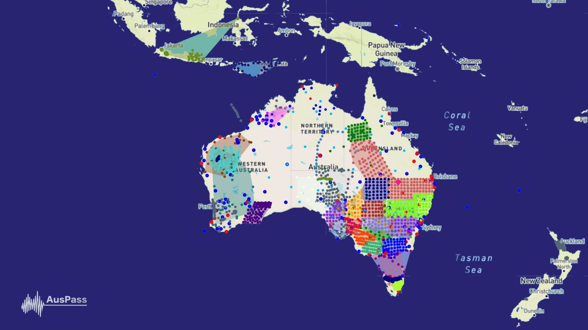
Browse AusPass data networks. Image: AuScope
Access is the key
A large number of geophysical data collections, previously stored in disparate locations around Australia, as well as virtual environments and software tools for geophysics, are now available to the entire research community. Storing data in this way, with significantly enhanced metadata, organisation and ongoing management, will provide the geophysics research community access to high-performing national-scale datasets at NCI for many years.
AuScope Director of Research Data Systems Dr Rebecca Farrington says,
"Before this project, Australian geoscience researchers faced challenges handling high-resolution data. This posed a risk to AuScope's future amid growing data size and complexity.
Collaborating with NCI enables open and FAIR access to curated datasets, software management, and streamlined processing and analyses, removing technical obstacles. Geophysical survey data processing, which took days or weeks, now happens within minutes at NCI.
This transformative capability has garnered global interest from researchers and industry alike"
NCI Deputy Director, HPC and Data Innovation, Dr Ben Evans, says,
“This project has provided Australian researchers access to a world-class computational and data science digital environment and platform suitable for future research in geoscience.
This includes integrating a diverse range of scientific software, assembling high-quality datasets within an HPC environment, and supporting collaborative research across the country.
This allows researchers to efficiently create workflows tailored to their specific use cases, leading to greater research innovation.”
The outcomes of the Geophysics 2030 collaboration are a testament to NCI’s ability to provide robust research infrastructure to whole research communities by integrating supercomputing, data storage, data collections management and software development expertise.
Supporting geophysical research in this way is only possible thanks to NCI's unique infrastructure and expertise.
The recent Processing and Modelling for 2030 Computation workshop
The Geophysical Research Data Processing and Modelling for 2030 Computation workshop was held at ANU’s Marie Reay Teaching Centre on the 21st and 22nd of November.
Participants were delivered tutorials and examples throughout the workshop and provided access to NCI’s GADI Australian Research Environment (ARE) via AuScope. Each participant had access to various computational notebooks using multiple GADI processors, NCI Geophysics environment and datasets made accessible by Geophysics2030.
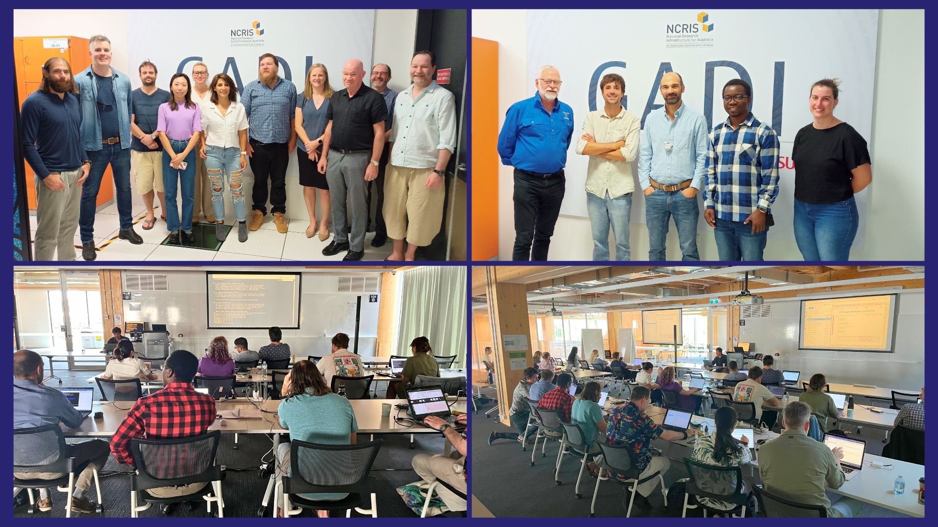
Photos from the recent Processing and Modelling for 2030 Computation workshop. Image: Rebecca Farrington
STORY IN A NUTSHELL
NCRIS organisations collaborate towards exascale computing in 2030
AUTHORS
Original article by Adam Huttner-Koros, National Computational Infrastructure (NCI)
Edited by Rebecca Farrington, AuScope & Philomena Manifold, AuScope
FURTHER INFORMATION
NCI’s Geophysics Specialise Environment
AuScope Magnetotellurics (MT) Collection, DOI
Australian Lithospheric Architecture Magnetotelluric Project (AusLAMP)
The Australian Passive Seismic Server (AusPass)
AusPass Passive Seismic Collection at NCI, DOI
National Collaborative Research Infrastructure Strategy (NCRIS)